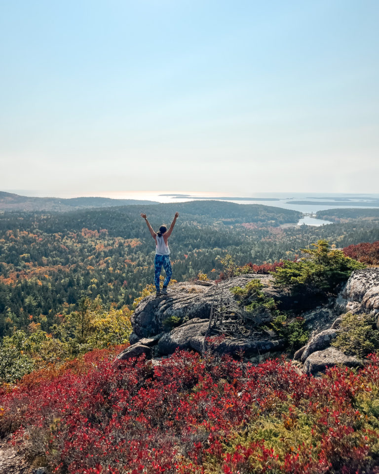
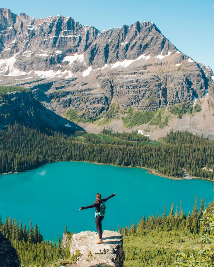
With countless vibrant blue lakes, tall, rugged mountain peaks, and gorgeous larches, the Alpine Circuit in Canada may be the prettiest hike in the entire country! 😮 This trail, nestled in the Canadian Rockies in Yoho National Park, British Columbia, will absolutely blow you away. So, get ready to take on the Alpine Circuit with this guide.
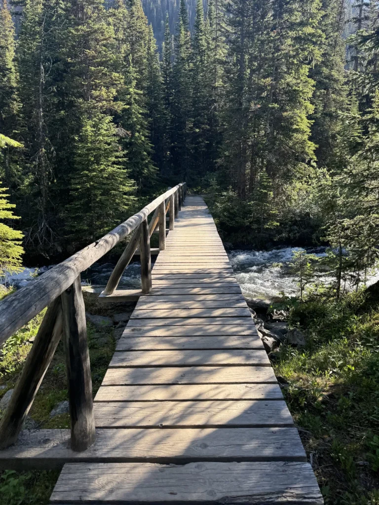
One of the craziest parts of this hike, is that the only way to get there is to be one of the lucky few to win a shuttle to Lake O’Hara or walk 7 miles (11 km) to the lake. It’s one of the most peaceful places that you could possibly visit.
I was one of the lucky people to win a shuttle ticket to Lake O’Hara in the summer. We decided to conquer the Alpine Circuit trail and it may be my favorite hike I’ve ever done. So, I’ve created this guide so that you can conquer it too!
Although this trail is remarkable, it’s not for beginners! Make sure to plan ahead and know what you’re getting into before you head out. This guide includes details on getting shuttle tickets, tips on when to visit, and a detailed guide description. So, you’ll be equipped with everything you need to know!
Disclaimer: There are affiliate links in this blog post. I may get a small commission at no extra charge to you. Thanks for your support!
Visiting Lake O’Hara
Want to take on the Alpine Circuit? You’ll have to plan on how you will visit Lake O’Hara first. This incredible landscape is tucked away in the Canadian Rockies and requires a lot of logistics to visit! So read below on getting to this destination.
You can read all about it in my detailed guide too!
Things to Know Before You Go
💵 You need a Canada Parks Pass to visit Yoho National Park & Lake O’Hara. You can buy them at one of the booths or get them online in advance.
🎟 No personal vehicles are allowed at Lake O’Hara. You will need to win a shuttle ticket to get to Lake O’Hara or walk an 11 km (7 mile) one way road to get there. It requires planning in advance!
☀️ Weather in the mountains can change quickly. Make sure that you are prepared for your visit with waterproof gear and layers!
💵 There is a gift shop with souvenirs and some baked goods at Lake O’Hara. So, pack some cash if you plan on buying anything there!
⛺️ There is one campground at Lake O’Hara with 30 campsites. You must make reservations in advance!
🐻 The Alpine Circuit is in grizzly country, so pack bear spray and stay bear aware as you hike!
🦮 Pets are not allowed at Lake O’Hara because it is a very sensitive environment.
📵 There is no cell service in this area, so download Alltrails maps and have a plan before you go!
🅿️ Parking is off of the TransCanada Highway. There are plenty of spaces there as well as signs talking about the area.
⚠️ Lake O’Hara is closed for most of the year and only opens from late June through early October. Make sure to stay updated on the closures before you go!
🍃 Remember to follow the Leave No Trace Principles. As always, you want to leave nature looking better than you found it. They will do an orientation on your shuttle specifically about Lake O’Hara because it is such a sensitive environment.
How to Get to Lake O’Hara
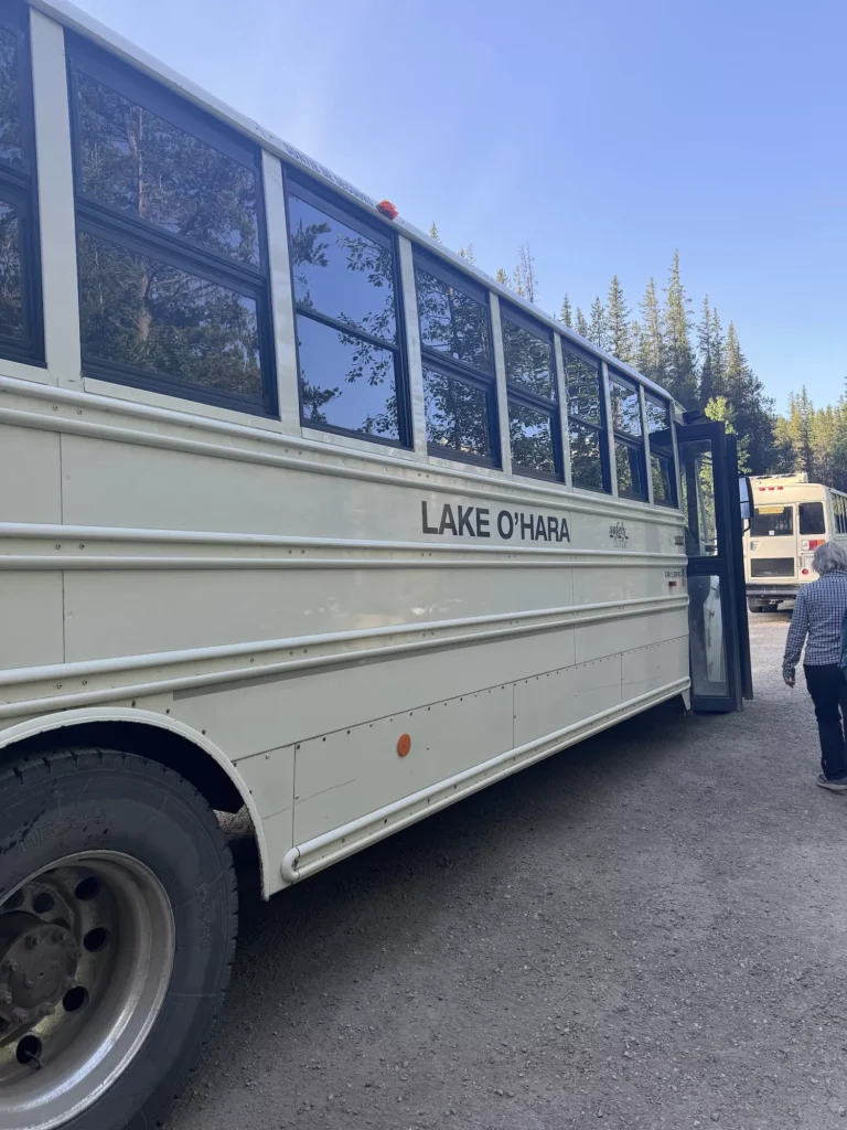
Lake O’Hara is one of the most protected landscapes in the Canadian Rockies, because of its fragile ecosystem. The only way to get to this wonderful part of Yoho National Park is to either win a shuttle bus ticket 🚌 or to hike 7 miles (11 km) on the access road.
You can read all about visiting Lake O’Hara at my guide here!
Shuttle tickets can be applied for in the lottery system. The lottery opens in March and results are given out at the end of March or in early April. But, they are very hard to win. I got lucky and got them on my first attempt. You can try your luck here!
Subscribe to campnab.com to get cancellation updates for shuttles or Lake O’Hara campgrounds!
Where to Stay Near Lake O’Hara

Yoho National Park is a stunning park in between the towns of Golden and Banff, Canada. It sits right over the province line in beautiful British Columbia.
You can try your luck to get camping permits at Lake O’Hara 🏕, which come out in late January or Lake O’Hara lodge reservations. They are some of the hardest permits and reservations to snag, so make sure to check the website and be ready with everything you need!
If you miss out on camping in Lake O’Hara, you can stay at a VRBO or one of the great hotels in Golden or Banff. Because this area is so popular, you will want to get hotels early.
Best Hotels in Banff & Golden:
- Fairmont Banff Springs
- Otter Hotel
- The Rimrock Hotel
- Canyon Ridge Lodge
- Vagabond Lodge at Kicking Horse
Best Time to Hike the Alpine Circuit in Lake O’Hara

Lake O’Hara is usually open from late June to early October. However, if you want to hike the entirety of the Alpine Circuit, the best time to go is from mid July to mid September.
If you go early or late in the season, then there may be snow at the peaks ❄️ and you may not be able to complete the entire loop. So, if you can try and time your visit for a better guarantee of when the route will be open.
We went in mid-July and there was still snow at the highest points of the hike!

Rangers will give you an update on the trail openings when you ride the bus to Lake O’Hara or you can ask them on arrival. But, you should always listen to them, because it can be dangerous to hike when there’s still snow!
Packing Guide for the Alpine Circuit

The Alpine Circuit is no joke and it shouldn’t be taken on lightly. If you are going to do this trail, make sure to have good poles, sturdy hiking boots, and plenty of food and water for your hike!
I also like to download the maps on Alltrails before I take on any hike!
Alpine Circuit Packing List
- Comfortable Hiking Boots
- Day Pack
- Hiking poles
- Water Reservoir
- 1-2 Liters of Water
- Snacks and Food
- First Aid Kit
- Sunscreen
- Bug Spray
- Bear Spray
- Headlamp
- Shelter
- Rain jacket
- Light winter jacket
- Base Layer
- Microspikes
- Good Hiking Pants/Bottoms
- Winter Hat (optional)
- Gloves (optional)
- Satellite phone
Alpine Circuit Trail Details
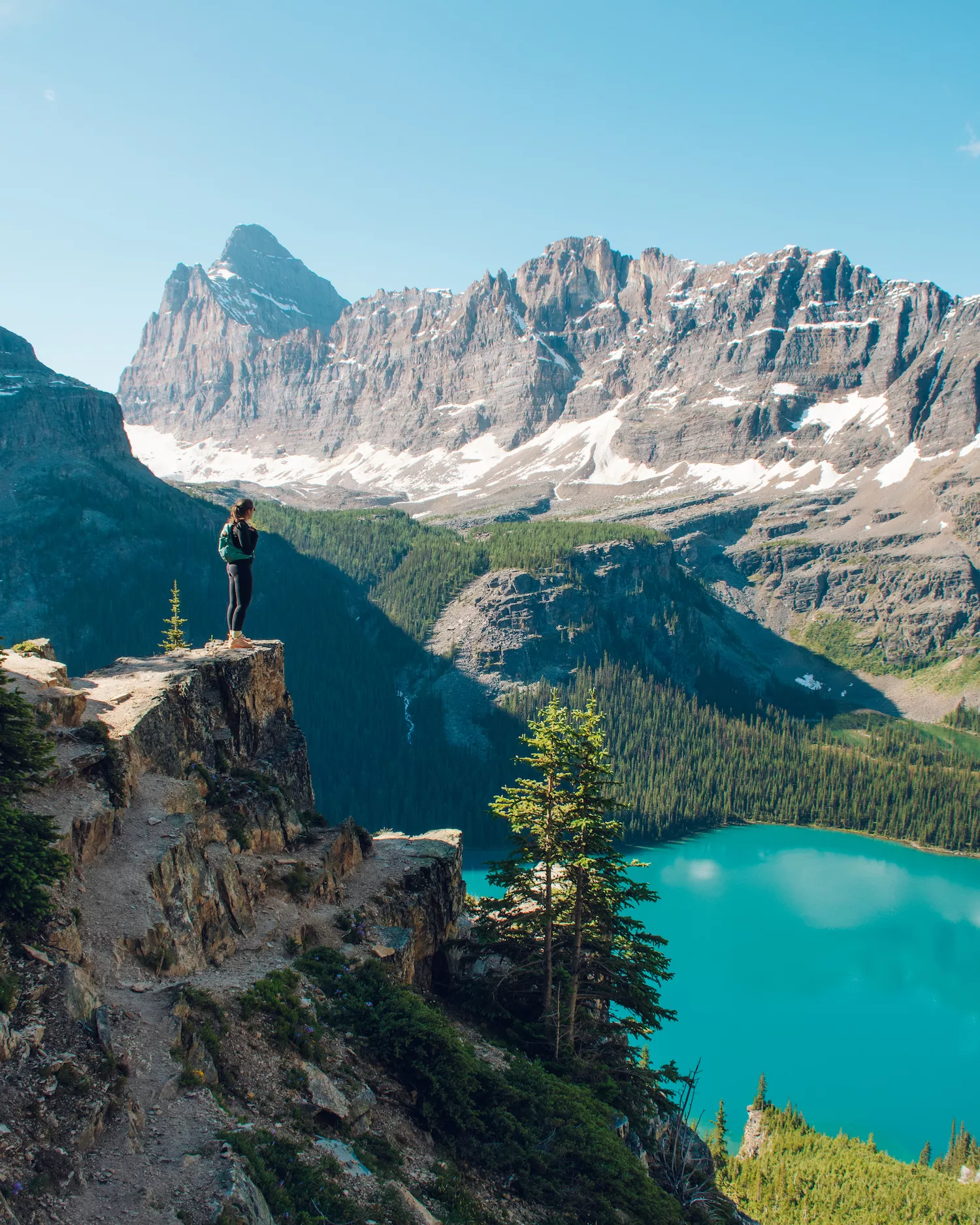
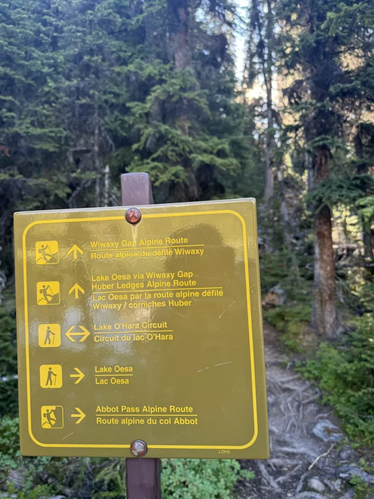
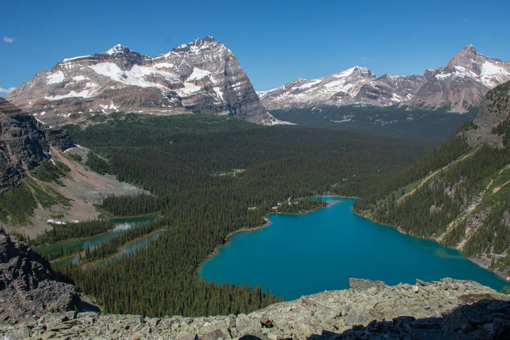
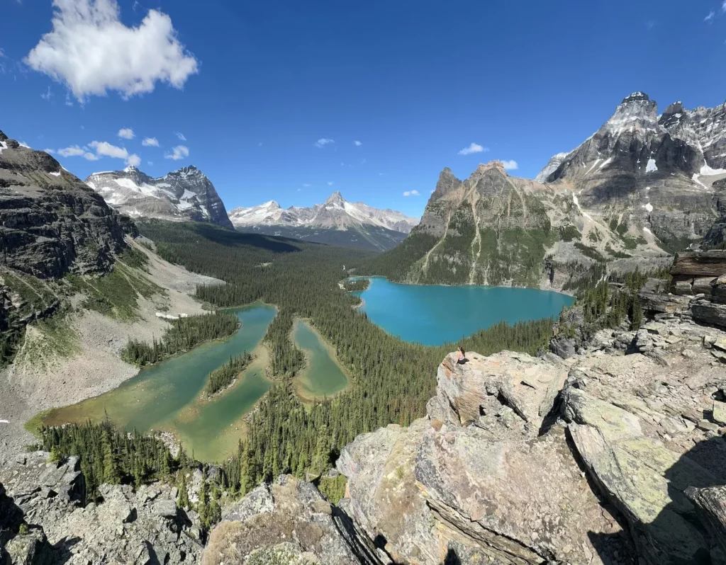
The Alpine Circuit is the ultimate hike in the Lake O’Hara area. It takes you over Wiwaxy Gap, down to Lake Oesa, up the Yukness Ledges, and finally to the top of All Soul’s Prospect.
There are a variety of ways to complete this trail, but most people choose to start it at Lake O’Hara and go clockwise. That way you get the steepest part of the trail out of the way. This guide will tell you about the Alpine Circuit trail in detail and go over the parts that I recommend adding to your hike.
Although the trail times may seem long, it takes into consideration the difficulty of the paths and how often you’ll stop. Plus, I stopped for photos every other minute on this hike because it’s that stunning. So, it gives extra time for that as well.
Make sure to follow the painted trail markers that are blue with two lines!
Quick Alpine Circuit Hike Stats
Distance: 6.8-7.5 miles (11 km-12 km)
Elevation: 2900 feet of gain (884 meters)
Type: Loop
Length: 5-7 hours
Difficulty: Hard
Lake O’Hara to Wiwaxy Gap
Distance: 1.1 miles (1.8 km)
Elevation: 1700 feet (550 meters)
Time: 1-2 hours
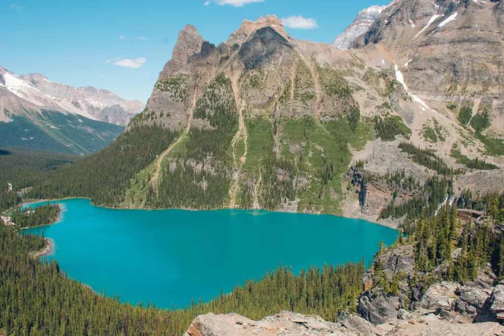
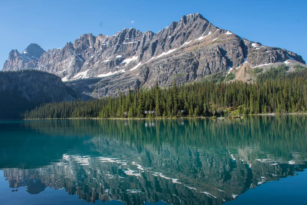
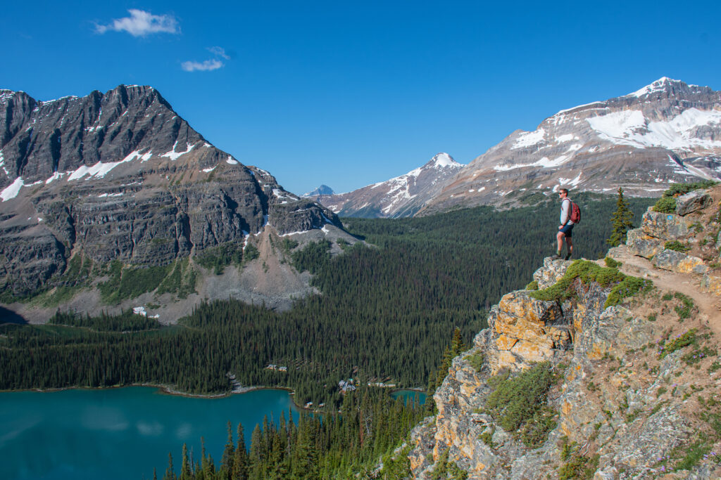
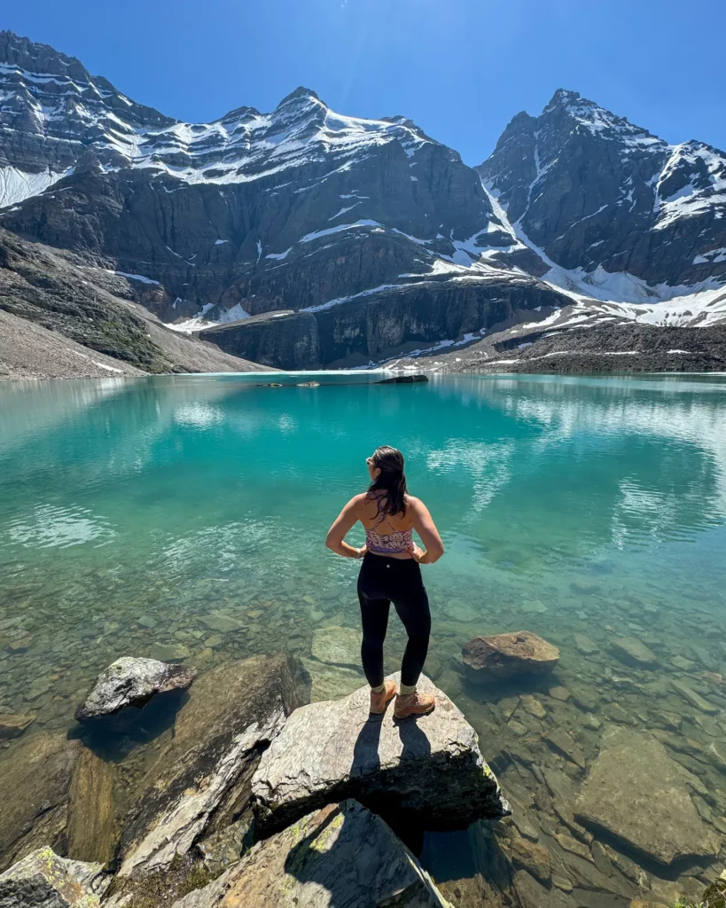
As soon as you start the Alpine Circuit trail at Lake O’Hara, you will be amazed! The water is a mesmerizing shade of turquoise and mountains surround it, creating an amphitheater. It’s an insane sight.
From there, you’ll continue around the lake until you see a sign for the Alpine Circuit trail towards Wiwaxy Gap. Right off the bat, you’ll be climbing up, up, up. In the first mile, you gain 2200 feet or 670 meters. 🥵 So, it’s not for the faint of heart.

There are some switchbacks through the woods and then it opens up. Luckily, you’ll see gorgeous views of the Lake below you, which is a perfect excuse to take a break as you go! There are a couple of points that are steeper, with a bit more exposure, but nothing that is too scary.
Finally, you’ll make your way up the last push to Wiwaxy Gap. From here, you’ll get views over the mountains to both sides and the trail finally flattens out a little bit. The hardest part is officially over.
Lake Oesa

Distance: 1.2 miles (1.8 km)
Elevation: -800 feet (-220 meters)
Time: 30 minutes to 1 hour
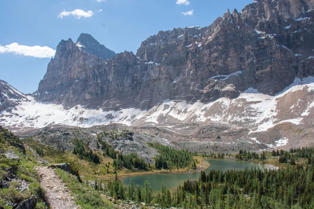
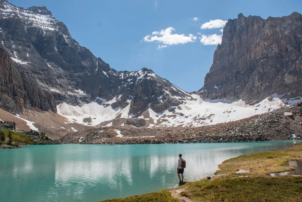
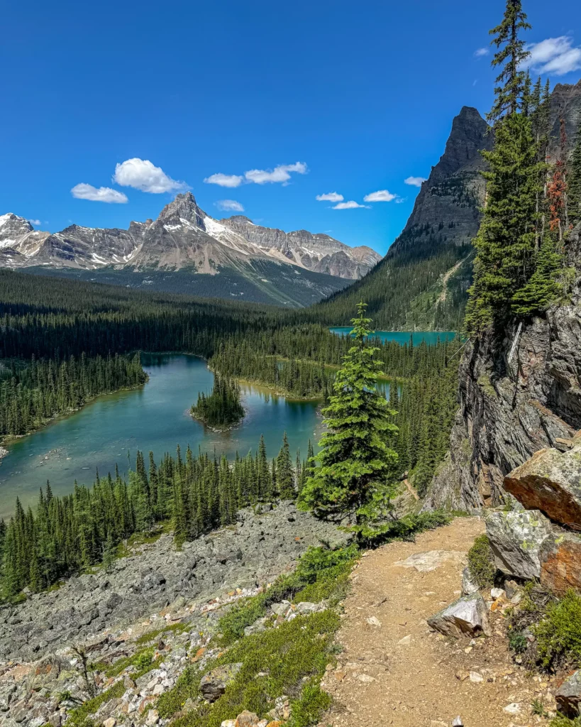
Finally, you can really enjoy the views as you make your way over the Huber Ledges and down to Lake Oesa. You’ll make your way over a rocky path, with views of the lake in front of you. Although, this part is downhill, it can be slippery with narrow ledges, so watch your footing as you go.
As you continue over this area, you’ll get to a point below that meets up with the Lake Oesa trail. Follow it straight to the lake.
You may notice more people at Lake Oesa, because there is a trail directly to this lake from Lake O’Hara. It’s a great place to sit and take a break or go for a swim in the later summer months before continuing on your journey!
Yukness Ledges & Optionally Opabin Lake
Distance: 2.2 miles (3.5 km)
Elevation: 200 (60 meters)
Time: 1-2 hours
From Lake Oesa, you’ll follow the signs for the Alpine Circuit and continue on the Yukness Ledges portion of this trail. This part of the trail does have a small incline, but but it’s only about 200 feet.
Keep your eyes peeled for marmots, because they love to hang in the rocks!
Although these ledges are some of the least steep, they can feel rather exposed at times with lots of rocks. So, just take your time and go slow. It can be easy to lose the trail at this point, because of the rockiness, which is why I always recommend having it downloaded.


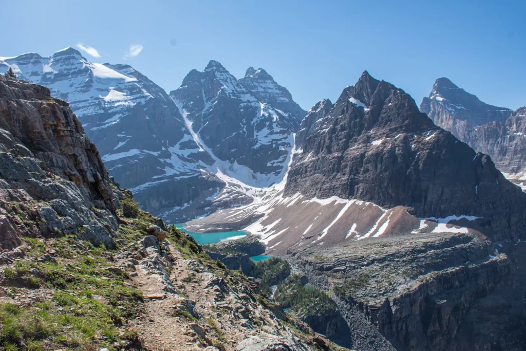
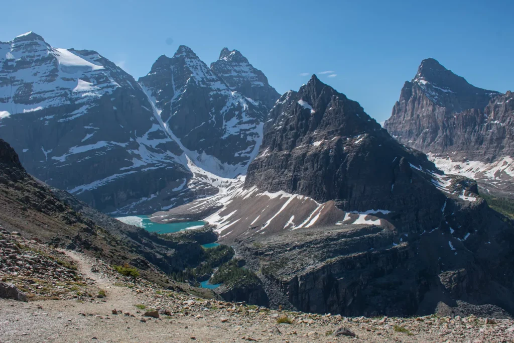
You’ll come around a bend and see a tall mountain peak ahead of you with a lake to the left. You can cross the trail there at Hungabee Lake or add Opabin Lake and eventually the Opabin Prospect to your route.
Although the technical “Alpine Circuit” trail skips right past this lake, I think you should go out of your way to see it! It adds just under .5 a mile to your hike and it’s one of my favorite points on the trail!
Obapin Plateau (Optional)
Distance: 1.2 miles (2 km)
Elevation: 100 feet (30 meters)
Time: 30 minutes to 1 hour
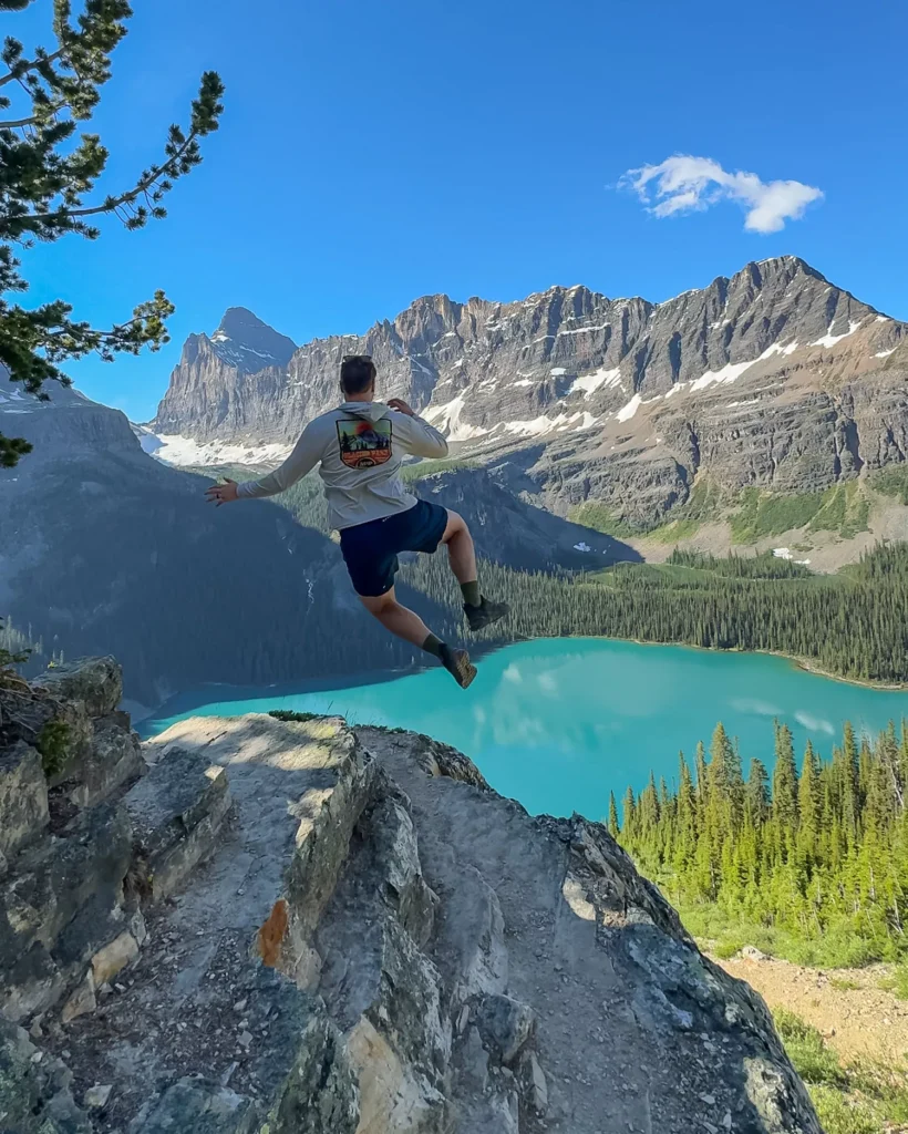
Once you get back to the intersection of Hungabee Lake, you can head straight over the Opabin Plateau to All Souls or make a detour to Opabin Prospect. Opabin Prospect is probably one of the coolest viewpoints in the entire area, so I highly recommend going out of your way for it!
This is definitely the most famous area in the park for pictures, so you don’t want to miss it!


Although it was a bit difficult for us to find at first. You’ll take a right after the junction with the Opabin Highline Trail. From there, you’ll follow the trail as you cross over a few lakes with gorgeous views of the mountains overhead.


Finally, you’ll find yourself walking through trees and out onto a cliff with breathtaking viewpoints of the lakes down below. There are a variety of spots to take a photo along the cliffs and they are rather wide, so it’s not too scary to visit. Once you’re satisfied with your photos you can continue onto All Souls or head back down to Lake O’Hara.
All Souls Prospect
Distance: 2 miles (3.2 km)
Elevation: 750 feet (230 meters)
Time: 2-3 hours
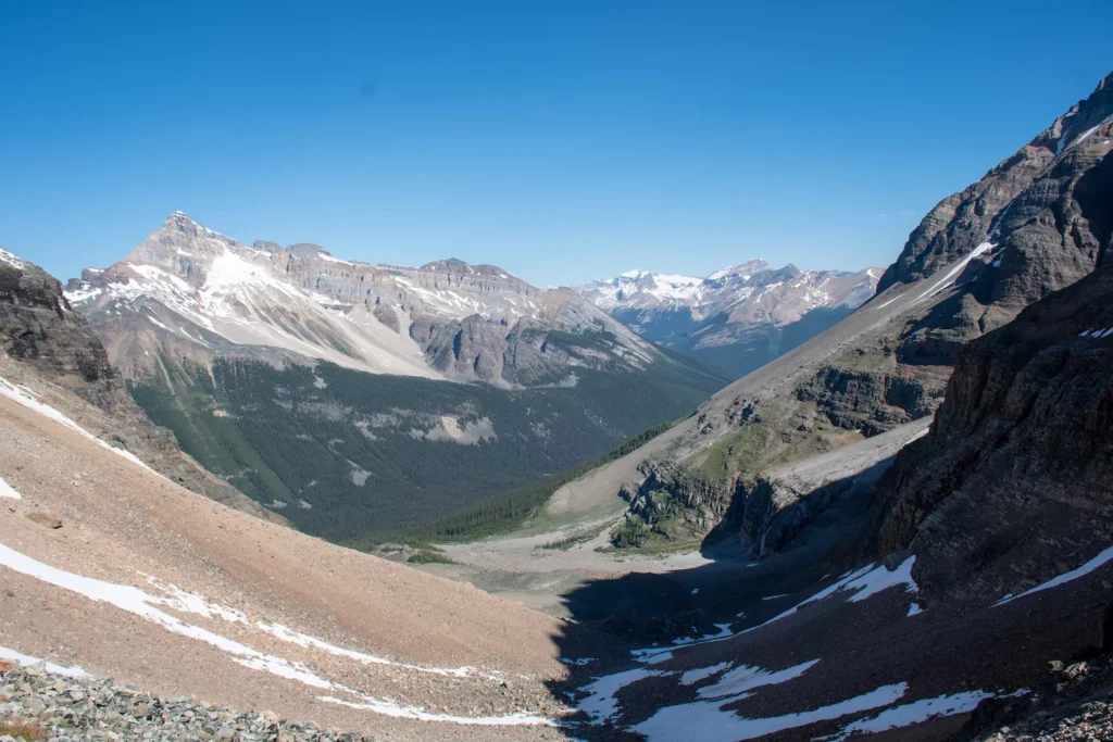
Sadly, this is the only part of the hike that we were unable to complete, because the snowpack was too large. However, I’ve done all of my research on it and know what it entails.
You’ll follow the West Opabin Plateau Trail over rocky sections and along a cliff until you make it around to the Northwest. This part of the trail is shade covered for most of the year, which means snow can linger here until the late summer. It’s also covered in scree or loose rock, so be careful and take your time!
You’ll have one final push, where you’ll gain 600 feet (180 meters) in just half a mile (.8 km). Although it’s difficult, the view at the top is incredible with Wiwaxy Gap across from you and Lake O’Hara directly below.
From there, you’ll descend the steep trail to Schaeffer Lake until you get to the trees and the junction with Alpine Meadows. From there, you’ll follow that trail past the Elizabeth Parker Hut and back to the beginning at Le Relais.

Make sure to reward yourself with carrot cake at Le Relais. It’s possibly the best carrot cake that I have ever tasted!
Final Tips for Hiking the Alpine Circuit
Although the Alpine Circuit is a challenging trail, it’s also the most remarkable hike that I have ever taken. Everywhere you go on this hike there’s absolutely mind-boggling beauty! So, if you want to take it on, just remember these things.
If you are hiking the access road into Lake O’Hara, give yourself plenty of extra time! Plus, you’ll be stopping every minute for photos on the hike. This trail is long and so is that walk, so you will be tired after a long day. Pack plenty of food and cash for the store at Le Regais. Finally, download the maps so that you don’t get lost and enjoy the hike!
Let me know if you enjoyed this trail guide in the comments!
📍 Pin Guide to the Incredible Alpine Circuit Hike in Lake O’Hara to Pinterest