
Explore the remote Alaskan wilderness on an epic trek to the peak of Tanalian Mountain 🏔. This austere formation sits above the incredible scenery of Lake Clark National Park.
This park is one of the least visited parks in the country, because it’s hard to travel there. However, my husband and I have made it our mission to see all the national parks and this was number 53 🎉! We were in awe of the magical beauty of this lake and this mountainous region.
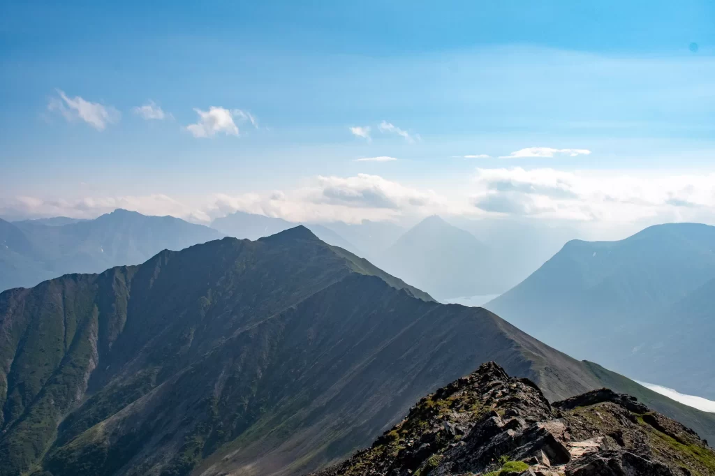
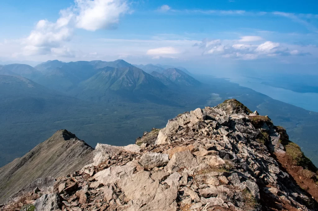
Hiking up to the top of Tanalian Mountain is no easy feat, at 3800 feat and a fair amount of rock scrambling. But, you can stop below and you’ll still get incredible views with sights of the lake surrounded by the tall mountains. If you make it to the summit, then you’ll be in for a treat with 360 degree views 🤩 of the area!
Read below for my comprehensive guide to hiking Tanalian Mountain including the best time to go, a packing guide, and a detailed trail description.
Tanalian Mountain Trail Guide
Quick Hike Info
Distance: 8.6-12 miles
Elevation: 2200-4000 feet of gain
Type: Loop Trail or Out and Back
Length: 6-9 hours total (depends on how much you want to explore)
Difficulty: Hard (It’s a very steep climb to the summit and over rocky terrain)
Tanalian Mountain Location
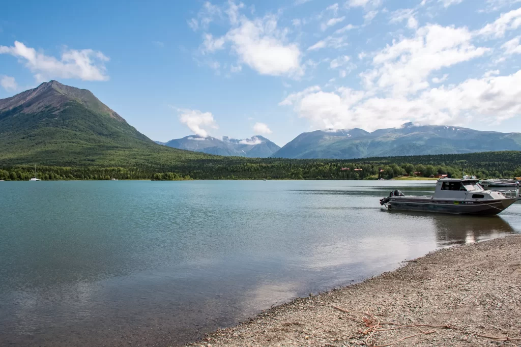
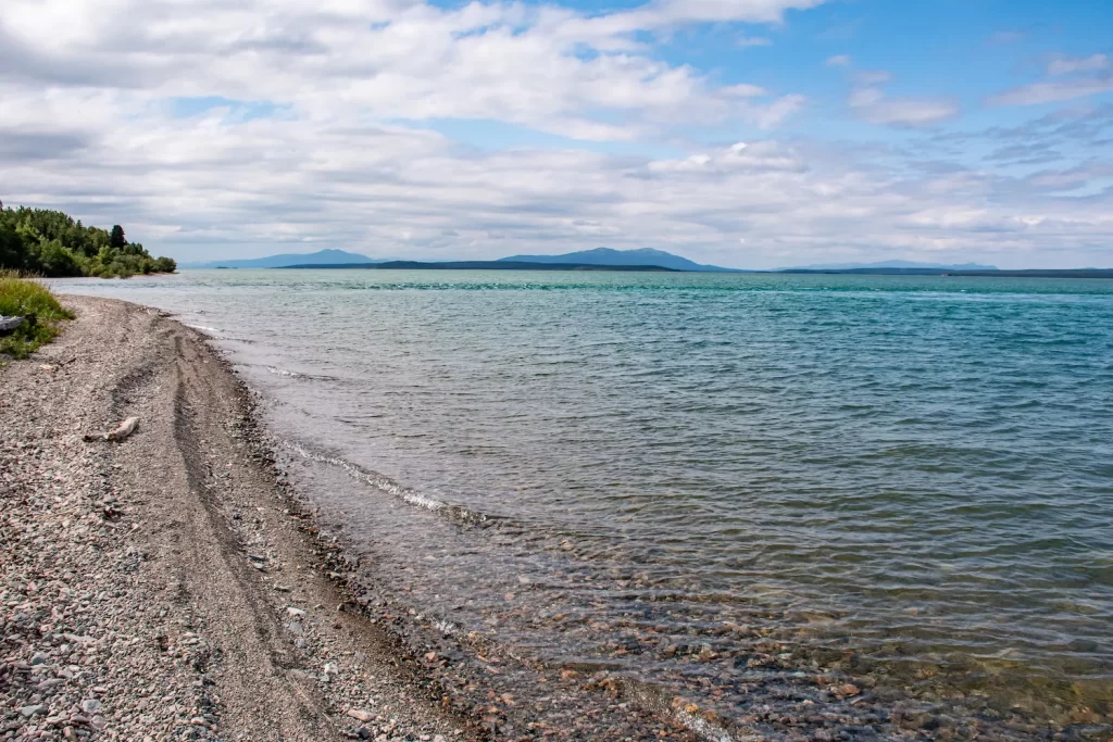
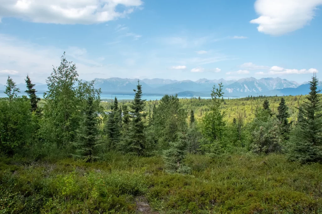
Tanalian Mountain is the tall mountain that looms over Port Alsworth in Lake Clark National Park along the Cook Inlet.
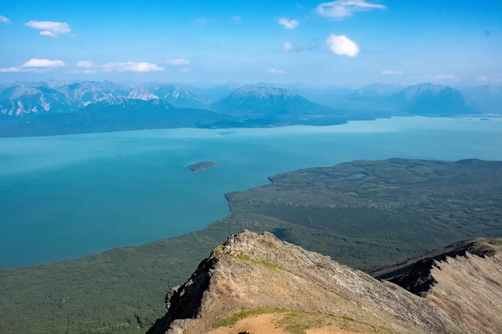
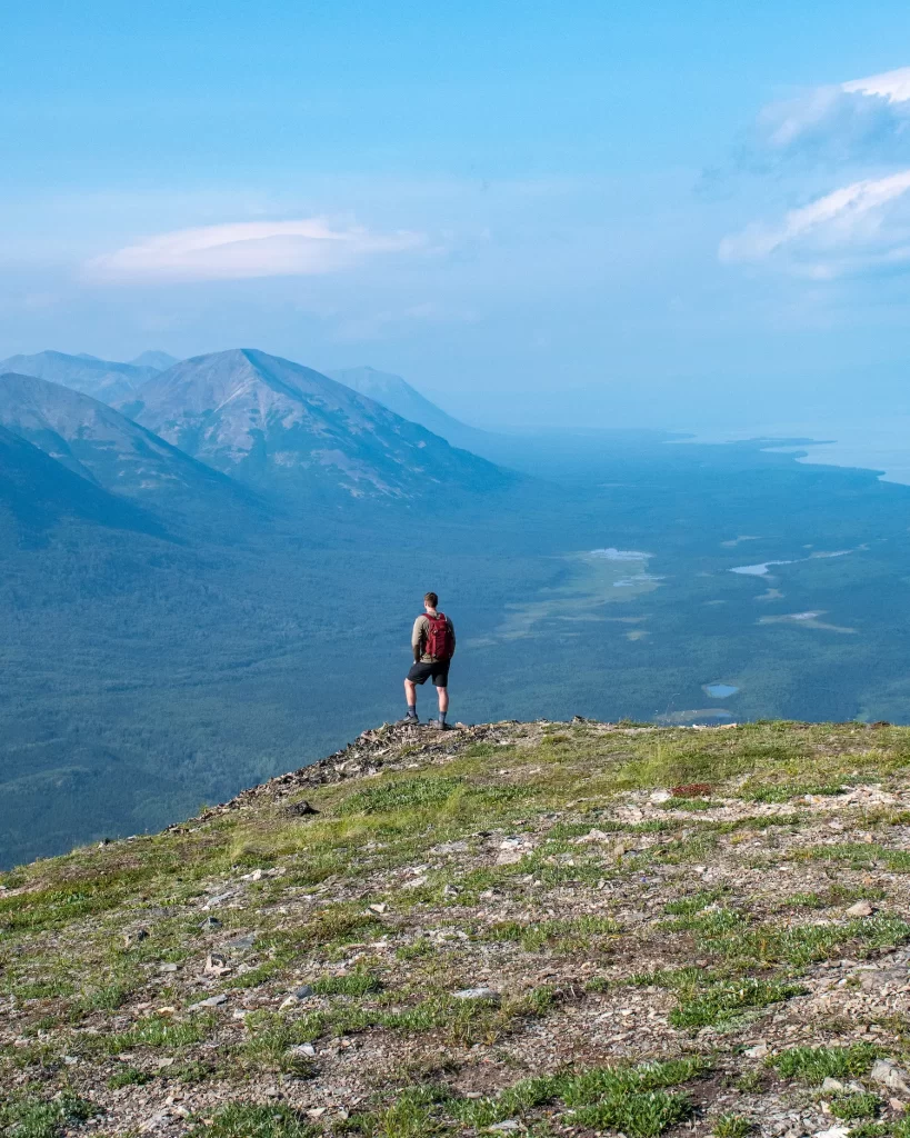
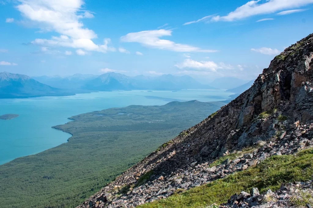
The peak is at 3800 feet above sea level and offers panoramic views over Lake Clark.
This park is one of the most remote in the United States and one of the least visited because of its location. However, the Tanalian trail system is one of the few well-maintained trails in the park.

To get to the Tanalian Mountain trail, you’ll have the choice between walking along the Beaver Pond or Tanalian Falls paths to get there. It’s about 1.7 miles from the beginning of the trail system. Then, you can begin your ascent!
How to Get to Lake Clark National Park
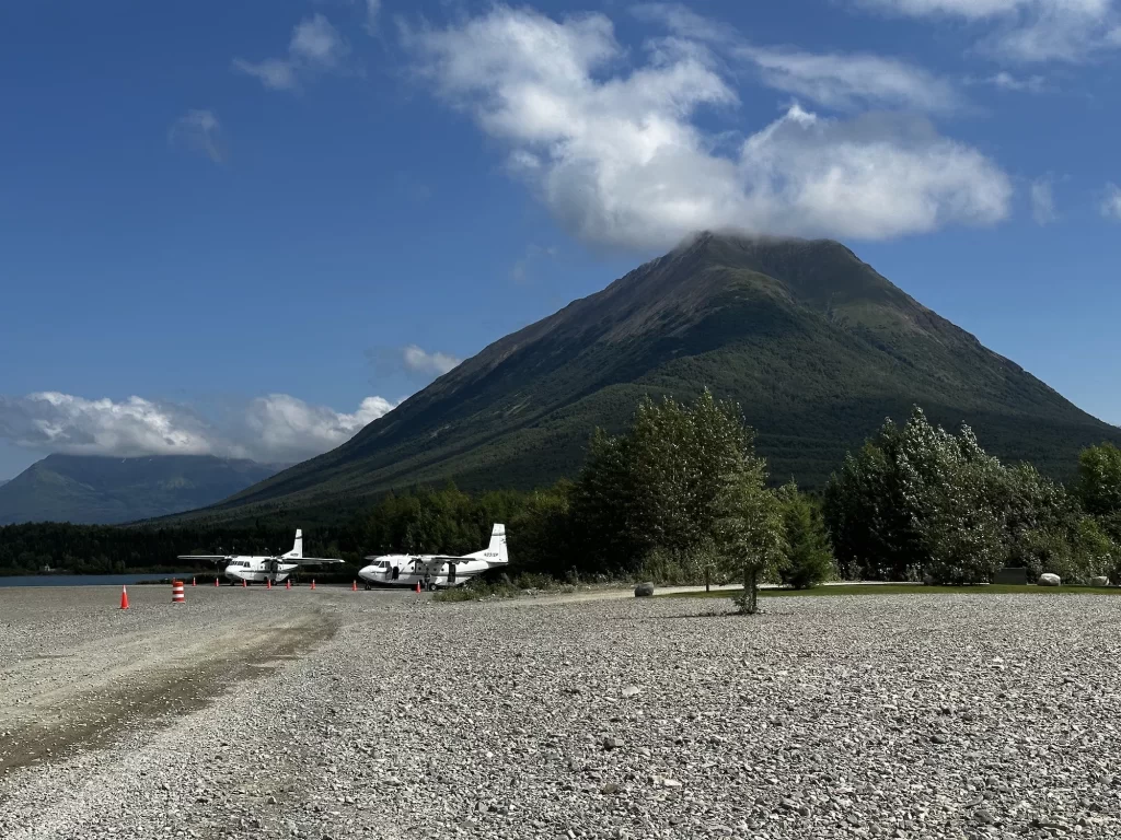
Getting to Lake Clark seems much more complicated than it is in reality. However, it is a bit pricey. The only way to get to Lake Clark is to take a float plane or a small charter plane ✈️.
There are a few designated airline carriers that will take you from Anchorage, Homer, or Kenai to Port Alsworth in Lake Clark. Flights usually run upwards of $500 💸💸 for one round trip priced ticket. You can read more about all of the airline carriers here.

Airlines with Flights to Port Alsworth:
- Lake and Peninsula Airlines (Anchorage)
- Lake Clark Air (Anchorage)
- Adventure Airways (Homer)
- Smokey Bay Air (Homer)
- Alaska West Air (Sodoltna)
Flying from Anchorage

We flew with Lake and Peninsula Airlines and had a fantastic experience. In fact, it was the most scenic flight of my entire life!
It’s just over an hour flight ⏱ from Anchorage. Once you get to Lake Clark, you’ll mostly have to walk around Port Alsworth, because there are no car rentals there. But, everything is relatively close!
Best Time to Hike Tanalian Mountain
The best time to hike Tanalian Mountain is in the summer. This is when you’ll get the nicest weather with warmer temperatures ☀️ and lush forests.
The best time to hike Tanalian Mountain is between June and September
Like most other destinations in Alaska, the summer is short and temperatures quickly drop in the Fall. Snow ❄️ may start to accumulate on the top of Tanalian Mountain early in the Fall and it will not stop in the winter. So, it can be dangerous to hike until that’s melted in early-summer.
While Lake Clark is open year round, most businesses and the visitor center in Port Alsworth are only open in the summertime. So, this is the easiest time to get lodging and other resources that you may need.
Things to Know Before You Go
💵 There is no entrance fee to get into Lake Clark National Park. However, you will need to get there, which usually requires a charter flight or float plane. These usually start at $500 round trip.
☀️ Weather changes quickly in the mountains and especially at the Tanalian Mountain summit. Rain is frequent in this area as well as snow, so just be prepared with waterproof layers and proper foot wear.
📵 There is no cell phone service within the park. So, you should have all you need downloaded before you go.
⛺️ Tulchina Adventures runs an established campground a mile from the trailhead. But, you can also look into other backpacking options for Tanalian Mountain camping including options on the connecting Tanalian saddle trail.
🐻 This is grizzly and brown bear country! Make sure that you stay bear aware and carry bear spray with you on the trails.
🦮 Pets are allowed in Lake Clark, but rangers recommend that you leave them at home. This is a wilderness area with lots of other wildlife that can be a threat to them.
⚠️ Most facilities in Lake Clark are only open in the summer from June to August. But, you can go to Port Alsworth year round.
🍃 Remember to follow the Leave No Trace Principles. As always, you want to leave nature looking better than you found it.
Tanalian Mountain Trail Description
Beaver Pond

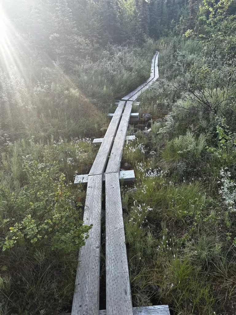
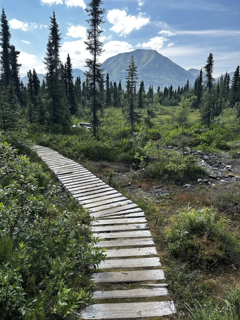
I suggest starting the hike on the Beaver Pond trail, which is a 1.7 path through the forest that gains 500 feet of elevation.
But, it’s very straightforward and mostly an easy hike. You’ll walk over roots and boardwalk trails. At the end of the path it splits off in two, one trail, to the right, goes closer to Beaver Pond and the other, to the left ⬅️, will lead up to Tanalian Mountain.

We chose to skip out on getting closer to Beaver Pond, but it’s just a short walk to do so.
Up the Mountain
Once you go to the left, you’ll walk a bit farther through the woods until you reach the sign for the junction. One direction points to Tanalian Mountain 🪧 and the other points to Tanalian Falls.
So, you’ll take the mountain trail and you’ll start to ascend through the forest 🌳. On this path you’ll have to walk over a few boulder steps, muddy switchbacks, and overgrown brush that may get you damp.

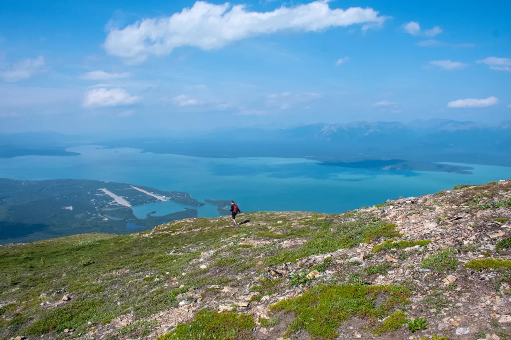
After 2 miles total into the trail, you’ll start to get to some viewpoints with panoramic views over the Port Alsworth area and Lake Clark. It gets even steeper as the forest line ends and you’re out in the open.
This climb starts to get very tiring 🥵, but the views continue to get better. The trail becomes a little unclear when the forest opens up, but as long as you continue up you’ll be fine.

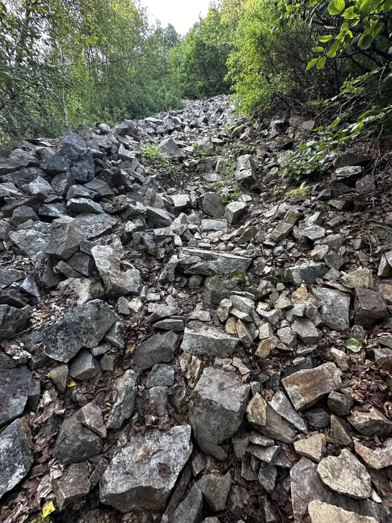
At about 4 miles in and 2200 feet you’ll see a rocky cairn 🪨. This is a great spot to make your stopping point, in fact most hikers stop here and go back down. There are stunning views in all directions and plenty of areas to choose to sit and enjoy a sandwich. I could have stayed here forever.
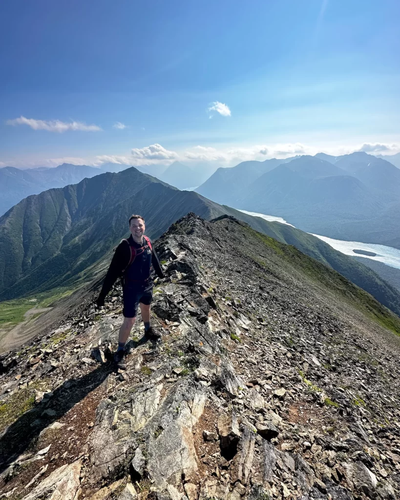
Unmaintained Summit Trail

This is the toughest point 💪🏻 of the trail, and the part most people choose to skip. It’s another 1200 feet in just a mile to reach the Tanalian Mountain summit over a rocky unmaintained path.
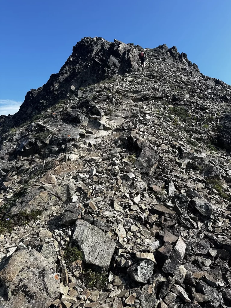
There is no clear path, but the best way to go up is to follow the ridgeline. But for those who are afraid of heights, this part gets VERY narrow and VERY STEEP! ⚠️ There were times that even I was getting hesitant, especially as the wind picked up.
Continue up and use three points of contact to make sure that you are stable on the mountain. You will be fine!
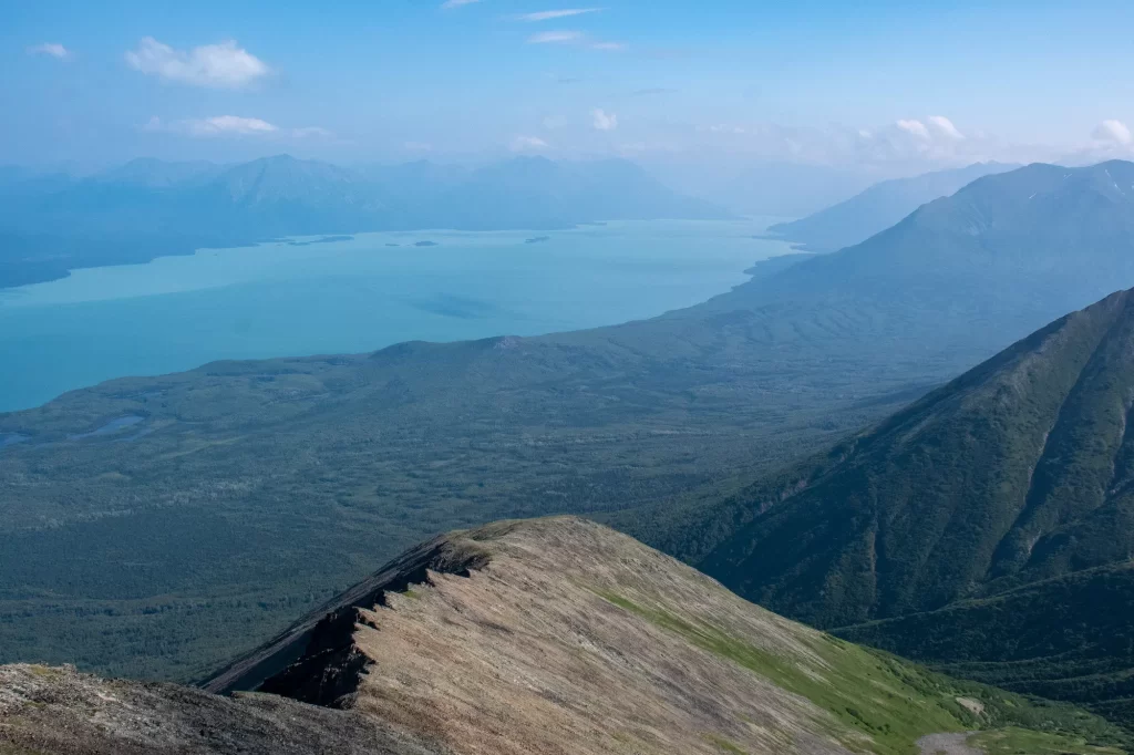

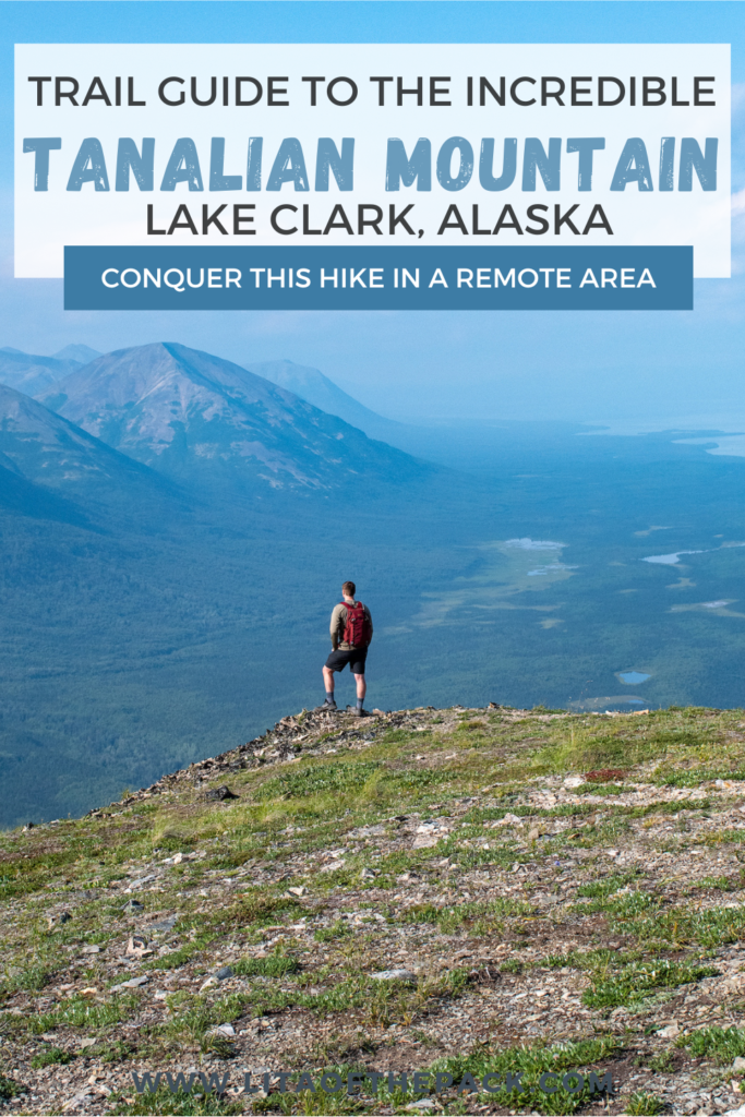
Finally, after a very tiring climb you’ll make it to the top!! From there, the views are absolutely breathtaking. You’ll get 360 degree views 👀 for miles over the area. I hope that you can rest and spend time taking it all in before heading back down.
Tanalian Falls
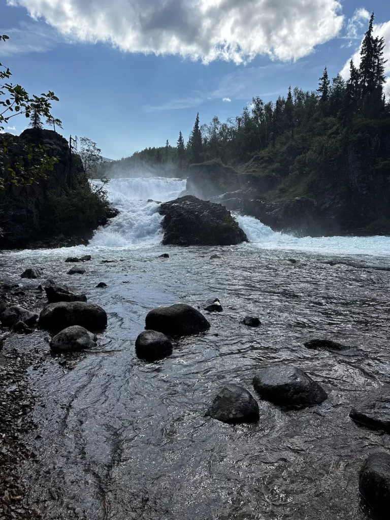
Once you’ve reached the summit, you’ll go back down the same way unless you want to see Tanalian Falls. This adds 1.6 miles and a couple hundred feet of elevation to your total hike. But, I think it’s worth it!
You’ll see the junction again for Tanalian Mountain and the Tanalian Falls Trail and you’ll take a left. Continue for .8 miles over a boardwalk trail and down through the forest until you get to the falls 💦!
We chose to walk to just the Lower Falls, but you can do the Lower, Upper, or both! It was a gorgeous gushing falls and they were stunning.
Packing Guide for Tanalian Mountain
This is a daunting trek up the mountain, so the most important thing is to pack layers and plenty of fuel. When we hiked up, we brought sandwiches 🥪, beef jerkey, trail mix, and bars to make sure that we could be properly energized.
Also, as it goes for most Alaska hikes, you will need to bring bear spray with you. Although we didn’t see any bears or any bear scat, it’s important to always be prepared. Especially in the Alaskan wilderness.
Packing List
- Comfortable Hiking Boots
- Day Pack
- Hiking poles
- 2-3 Liters of Water
- Snacks and Food
- First Aid Kit
- Sunscreen
- Bug Spray (very buggy trail)
- Headlamp
- Shelter
- Rain jacket or light winter jacket
- Satellite phone
- Downloaded AllTrails Map
Final Tips for Hiking Tanalian Mountain
Tanalian Mountain is a tough trail and getting to the summit is no joke! Make sure that you’re well prepared to make it up and download the trail map 📲. If you need, you can always decide to turn around below the summit.
This hike will provide some of the most scenic Alaska views. I hope you enjoy this wonderful Alaska hike!
Let me know in the comments if you enjoyed this trail guide!
You Might Also Like These Posts:
- An Unforgettable Day Hike: Reed Lakes Trail
- How to Hike the Root Glacier Trail in Wrangell-St Elias
- Guide to Visiting Port Alsworth- Lake Clark National Park
📍 Pin Guide to Conquering Tanalian Mountain to Pinterest


Hi Lita, do you think this hike is possible to do in one day including a flight from Anchorage? Or have you stayed in the campground for the night? Thank you! Meghan
Hi Meghan! I think it’s possible, but would be a very long day and probably rushed. I would suggest doing it if you’re staying for a night or shortening it and just doing part of it. We stayed in a cabin overnight!