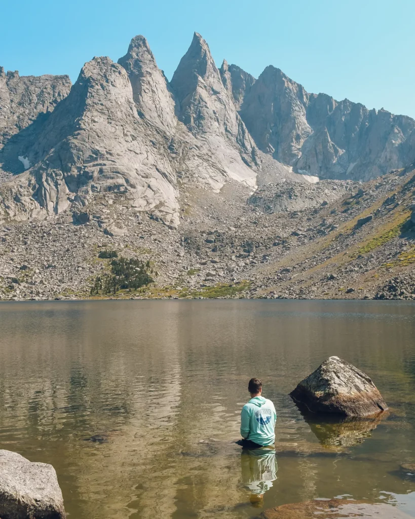
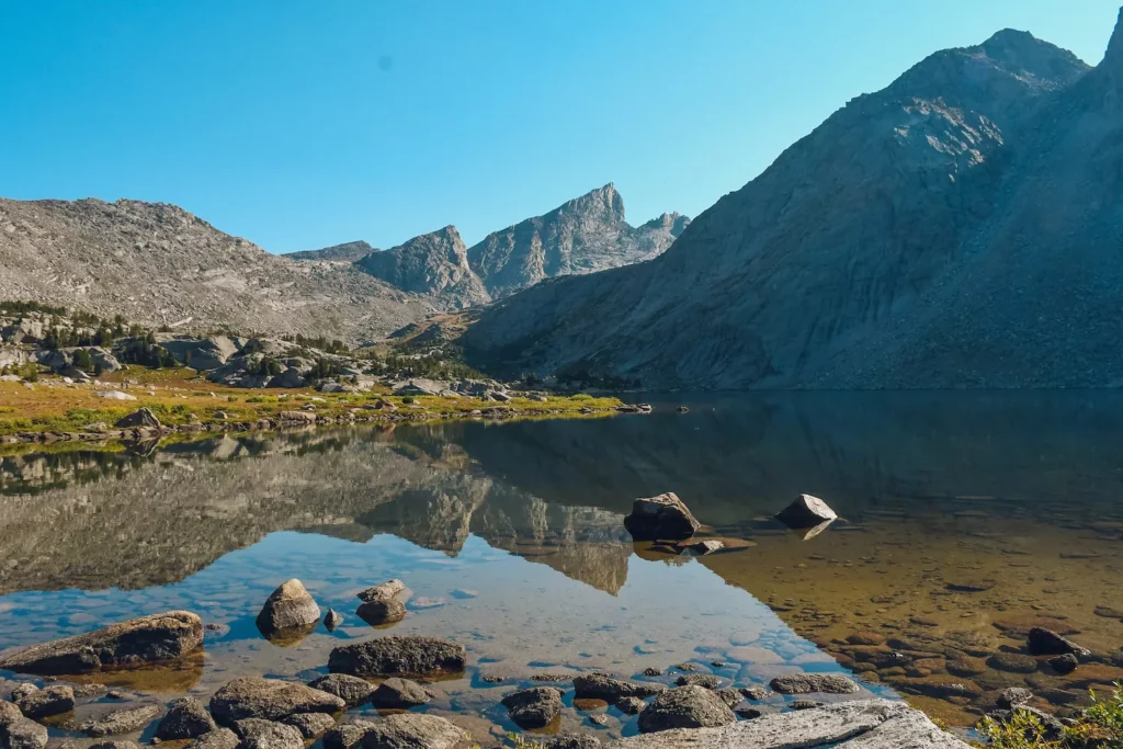
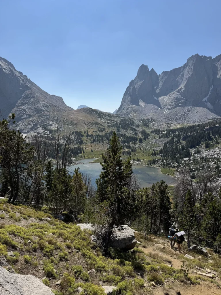
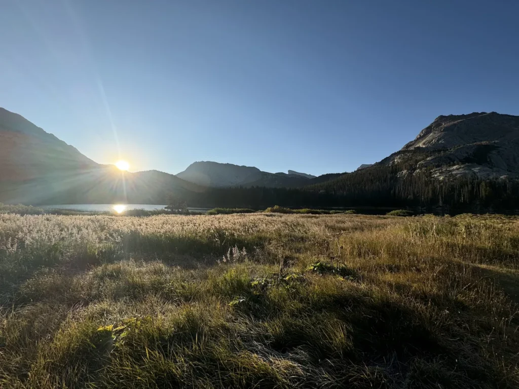
Stand among tall jagged mountain peaks as you relax by the cool waters of a shimmering lake. Taking a Cirque of the Towers backpacking trip in Wyoming will absolutely wow you. 🤩
This iconic area in Wind River is known for the majestic peaks that stand in a semi-circle and make up “The Cirque.” Pass by gorgeous lakes, see wildlife, and immerse yourself in the mountains. Although, don’t take this on lightly, this route is challenging and it’s not for beginners!
We completed this trek over Labor Day Weekend and I’ve been thinking about it ever since. I couldn’t get over the crazy landscapes that we saw and the sheer amount of natural beauty. Everywhere you turned on this trail was insanely gorgeous.
So, what are you waiting for? It’s time to complete the iconic “Cirque” backpacking route. I’ve created this guide for the Cirque of the Towers with everything you need including a detailed trail route description, tips for Wind River, and where to stay before your hike. So, read below!
You Might Also Like These Posts:
Disclaimer: There are affiliate links in this blog post. I may get a small commission at no extra charge to you. Thanks for your support!
Planning Guide Cirque of the Towers Backpacking Wind River

Cirque of the Towers Hiking Stats
Distance: 23-26 miles
Elevation: 3800-4100 feet
Type: Loop
Length: 1-3 Days (I recommend at least two)
Difficulty: Hard
Where is the Cirque of the Towers and Wind River
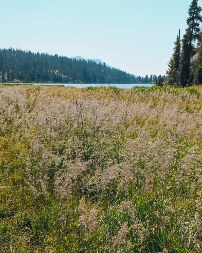
Wind River is an area of the Rocky Mountains in central Wyoming about 2 hours from Jackson Hole. The Wind River Range is over 2 million acres in the Bridger Teton Wilderness and is often referred to as the the Winds. 💨 It’s an extremely popular area to backpack and hike.
The Cirque of the Towers is one of the most popular backpacking routes in the Winds.
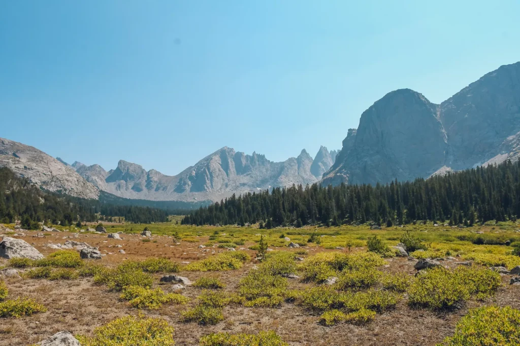
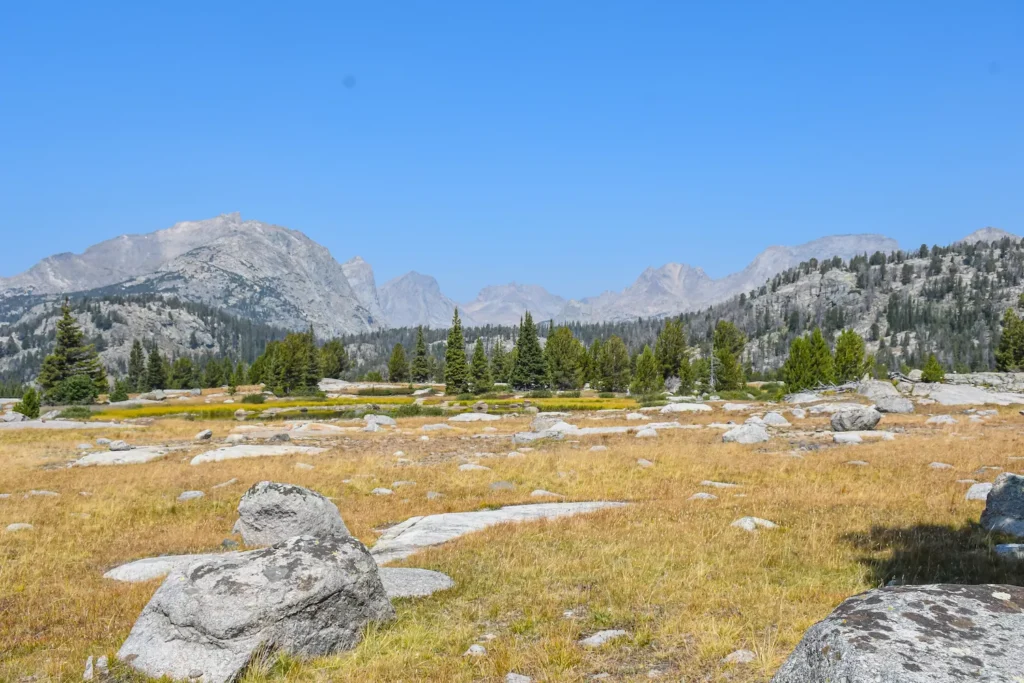
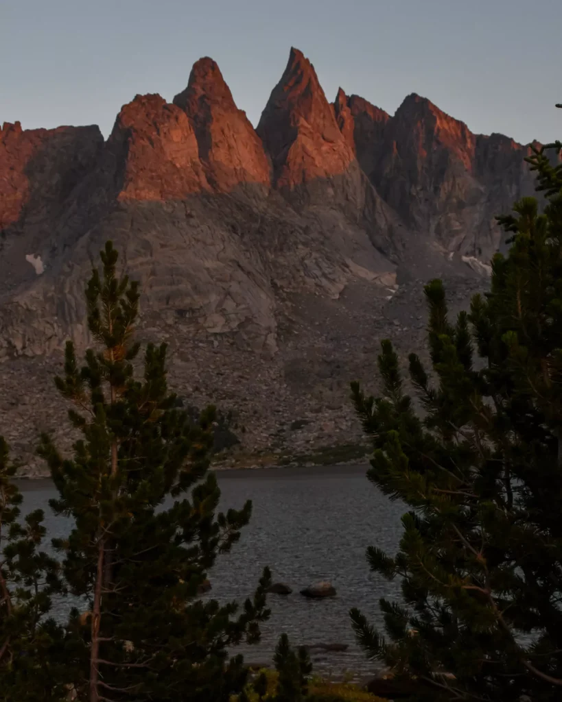
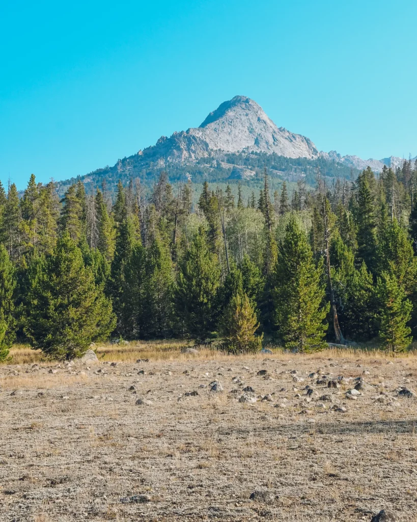
Many people refer to this area as “The Cirque” and it refers to a semi-circle of mountains in the Winds. This incredible portion of the Winds follows the Continental Divide Trail and features fifteen peaks that are 12000 feet high.
It’s one of the most stunning areas you’ll ever visit! 😮
How to Get to Wind River
Although Wind River is a pretty remote area of Wyoming, it’s not that far from other destinations. The closest airports to Wind River are:
✈️ Jackson Hole Airport ~1.5 hour drive
✈️ Salt Lake City ~4 hour drive
Once you fly into an airport, you’re going to want to get a rental car because you’ve got a long drive ahead of you. 🚗 I also recommend renting something with high clearance, because the road to get into the Cirque of the Towers Trailhead is very bumpy.
You’ll want to put the “Big Sandy Trailhead” into your GPS, because that’s where the Cirque of the Towers loop leaves from!
Cirque of the Tower Backpacking Tips
Whether you’re a first time backpacking or a seasoned trail rat, you should still keep these things in mind when you take on the Cirque of the Towers Loop.
🅿️ Parking gets very crowded at this trailhead and you may have to park half a mile away. But, you can camp in this area/near the cars overnight, if you want to stay the night before or after your trek.
💦 You must filter all the water to drink it. However, you CANNOT DRINK THE WATER AT LONESOME LAKE. It’s been contaminated by fecal matter.
💩 There are no toilets on this loop and it’s very crowded. So, you should pack wag bags to pick up your waste, so that you can protect this ecosystem. They had to close camping near Lonesome Lake, because of human feces getting into the water!
🗑 That being said, there are no trashcans on the trail. Which means, you need to pack out everything you bring. We often put our used food items in a plastic bag in our bear container.
⛺️ You must set up camp 200 feet from any of the water sources and a quarter mile from Lonesome Lake. Sadly, I saw people setting up right next to the lakes, DO NOT DO THAT!
🎟 There are wilderness permits on the trailhead, that you need to fill out for your group. Luckily, they’re free.
🦮 Pets are allowed and even can be off-leash in certain areas!
🔥 Campfires are NEVER allowed along this loop due to limited firewood. Please follow the regulations and enjoy your campsite without a fire.
🐻 Wind River is bear country! Make sure to pack all of your food and scented products in bear safe containers. Always remember a fed bear is a dead bear.
🌿 As always, follow the Leave No Trace Principles. Stay on the trail and pack up after yourself!
Packing Guide for Wind River
Snow clings onto these mountain peaks deep into the summer and it can get incredibly chilly up in the peaks. So, it’s important to pack layers for your journey. We actually hiked this loop over Labor Day weekend and were pleasantly surprised at how warm it was!
Learn all about the backpacking gear you’ll need here! 🎒
Backpacking Packing Essentials
- Backpacking Tent
- Backpack
- Water Filter
- Bear Cannister
- Bear Spray
- Comfortable Hiking Boots
- Hiking Poles
- Jet Boil or Cooking System
- Quick Dry Towel
- Satellite Phone
Where to Stay in Wind River Before or After Your Hike
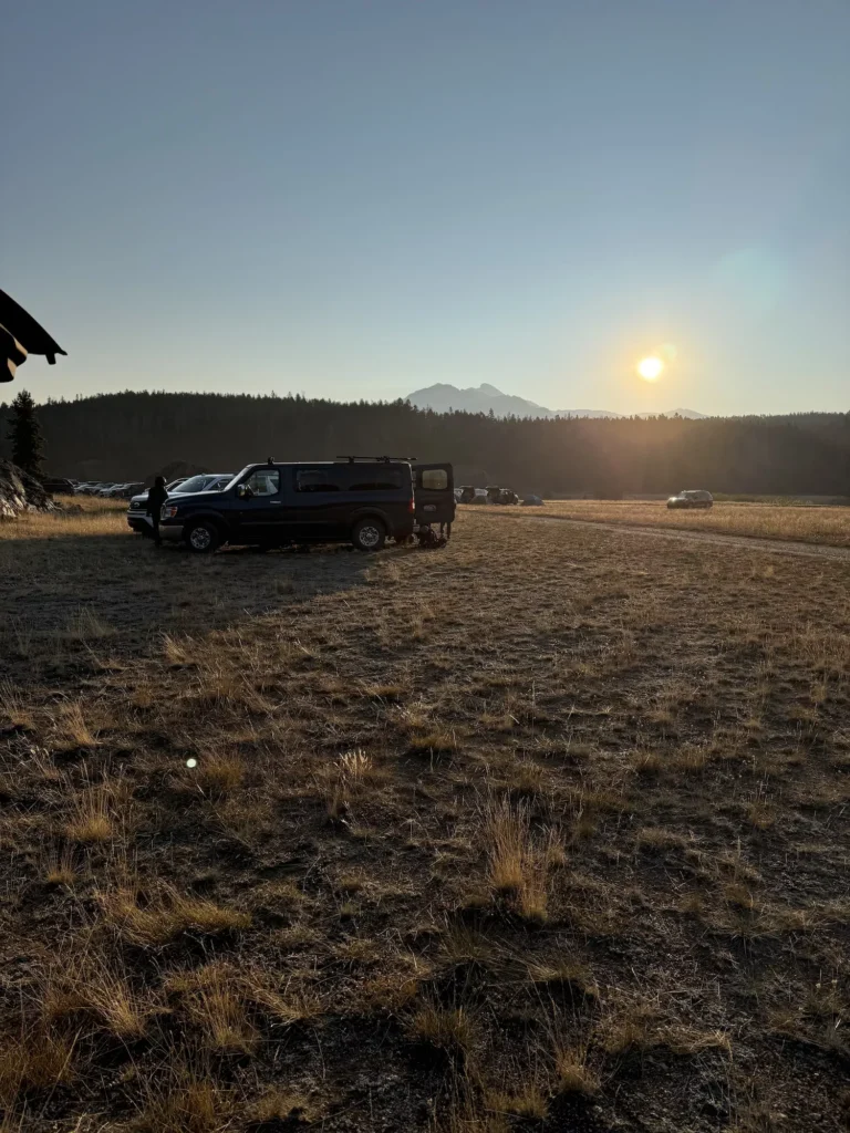
If you want to get an early start to your backpacking loop, then you can stay nearby in Pinedale or even camp at the trailhead! That’s what we did, we pulled in late at night and just set our tent up right next to the car. It was super easy to pack up and go the next morning.
Pinedale is a very small town about 90 minutes away from the trailhead. But, they have good lodging options if you want a bed to sleep in before or after your trek.
Best Lodging Pinedale:
Renting a Car for Your Trip
The best way to get to the Big Sandy Trailhead & start of the Cirque is to drive. Most airports are pretty far away. So, I recommend looking at cars on rentalcars.com. They compare prices from all rental companies and give you the cheapest options!
I would get a car with high clearance, because the drive to the trailhead can get bumpy.
Cirque of the Towers Backpacking Route
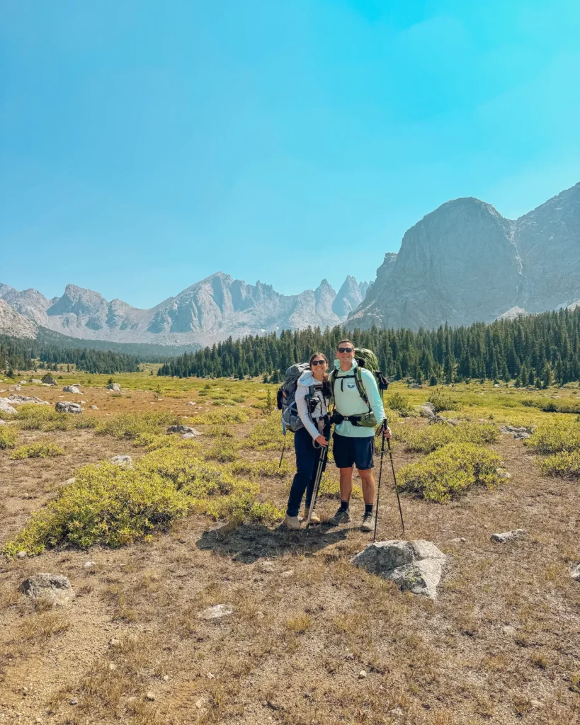
Now that all the logistics are taken care of, it’s time to plan your route in the Cirque. Most people who do the Cirque of the Towers backpacking routes spend at least 3 days on the trail. I recommend at minimum having three days and I would have even liked to have an extra day or two to spend more time at the lakes.
We did this trek on Labor Day weekend, so it was incredibly crowded with individuals from all over. Clearly, we were all trying to take advantage of the long weekend. 🙌🏻
Below you can read a detailed description of the route as well as where I recommend stopping on each day to camp!
Suggested Cirque of the Towers Backpacking Route
Below are my suggested routes. We only had three days, so we did the first option. But, if I had more time I would have loved to stay at other places on the way or added Papoose Lake to the route.
I do not recommend staying at Lonesome Lake, because you cannot drink the water there 🙅🏽♀️ and you have to stay a quarter mile from the lake! But, it’s a wonderful spot to stop and have lunch or take a break on your trek. It’s been contaminated from human feces.
Three Day Trip:
- Trailhead to Shadow Lake (10.3 miles, 1200 feet)
- Shadow Lake to Big Sandy Lake (3.6 miles, 700 feet)
- Big Sandy Lake to Trailhead (5.5 miles, 50 feet)
Four Day Trip:
- Trailhead to Dad’s Lake (5.7 miles, 600 Feet)
- Dad’s Lake to Shadow Lake (4.6 miles, 600 feet)
- Shadow Lake to Big Sandy Lake (3.6 miles, 700 feet)
- Big Sandy Lake to Trailhead (5.5 miles, 50 feet)
Five Day Trip
- Trailhead to Dad’s Lake (5.7 miles, 600 Feet)
- Dad’s Lake to Shadow Lake (4.6 miles, 600 feet)
- Shadow Lake to Lonesome Lake or Papoose (3.5-8 miles, 1100 feet to 1400 feet)
- Big Sandy Lake to Trailhead (5.5 miles, 50 feet)
Trailhead to Shadow Lake
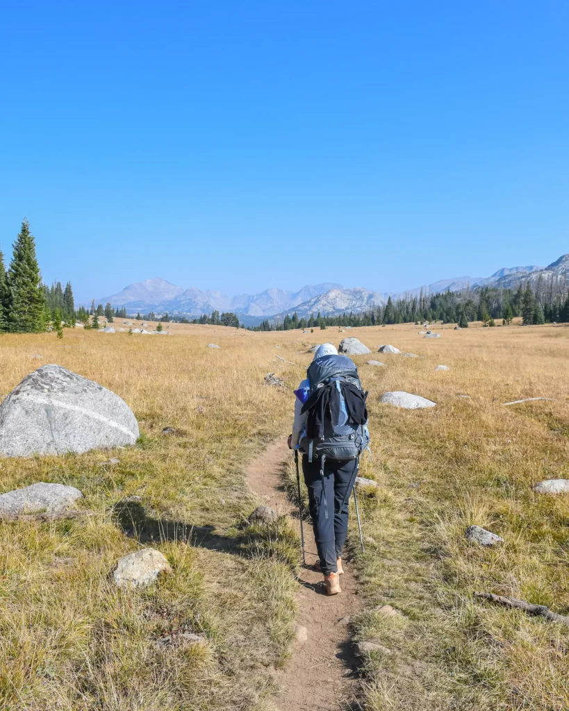
If you only have three days, then you’re going to have to kind of push it a bit. The Cirque of the Towers backpacking route is one of the tougher ones. 💪🏻 I suggest starting your first day doing ten miles all the way to Shadow Lake.
Although it’s a lot of distance, the elevation doesn’t feel that bad as you gain it over time with a steady incline. But once you get to the lake, you will definitely want to stop, put your backpack down and dip into the cool waters.
Distance: 10.3 miles
Elevation: 1200 Feet
Fremont Trail
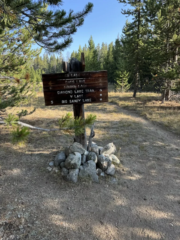
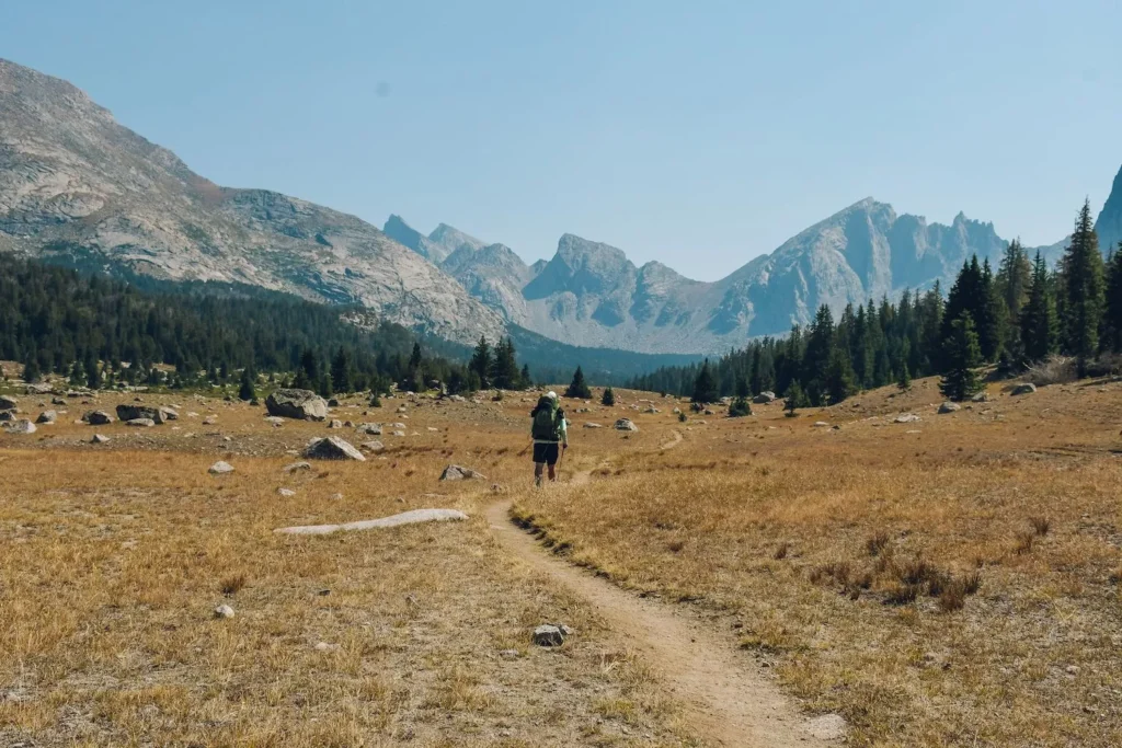
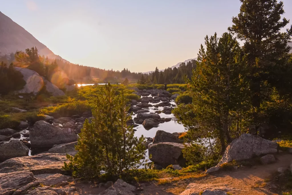
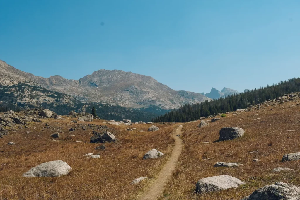
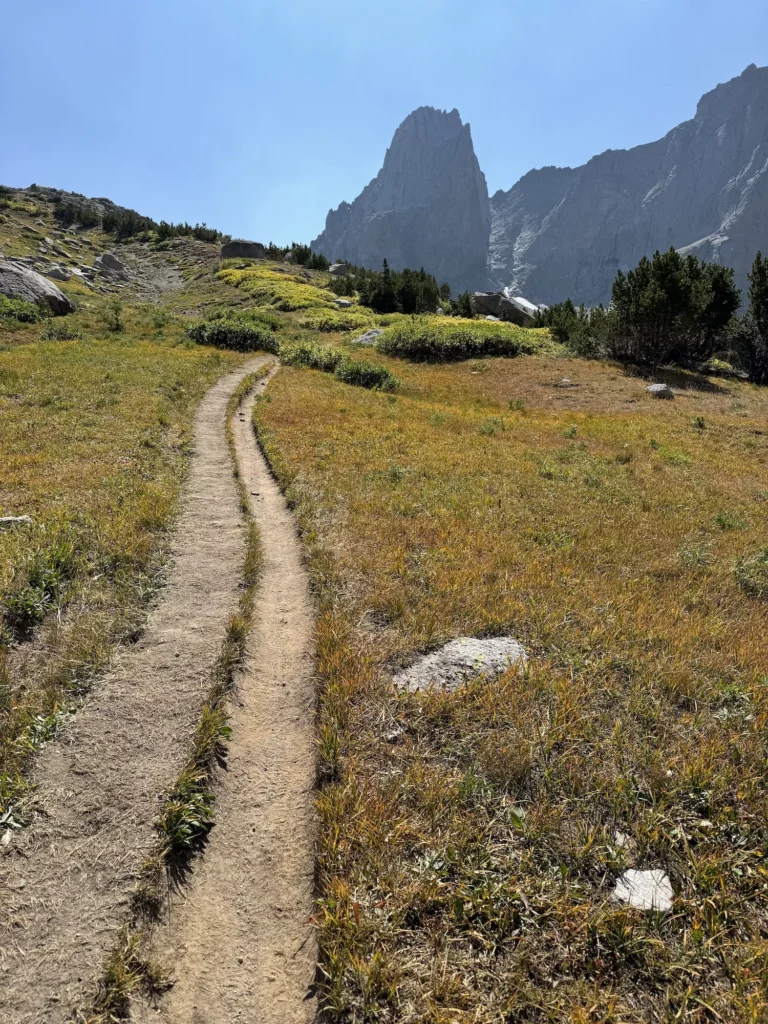
After you secure a parking spot by the Big Sandy Trailhead, you will see the trailhead sign. The trail starts in a straight line and is rather flat as you walk along the river. At half a mile, you will get to the fork for the Fremont Trail or the Big Sandy Lake trail, but it will say towards Dads Lake.
Turn left and head toward Dads Lake on the Fremont Trail. You want to complete this route in a clockwise direction.
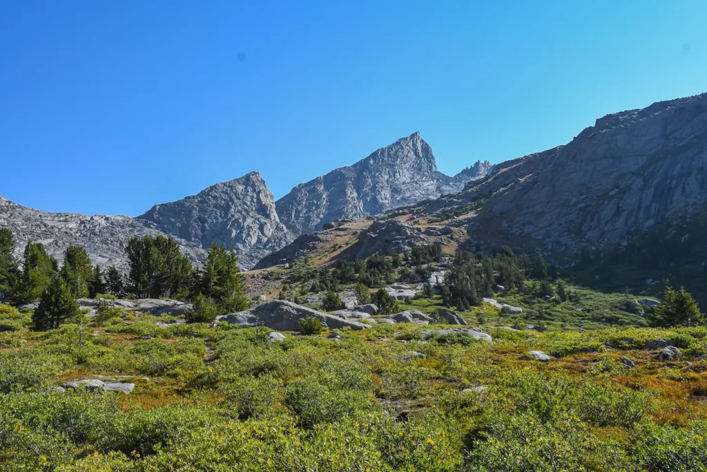
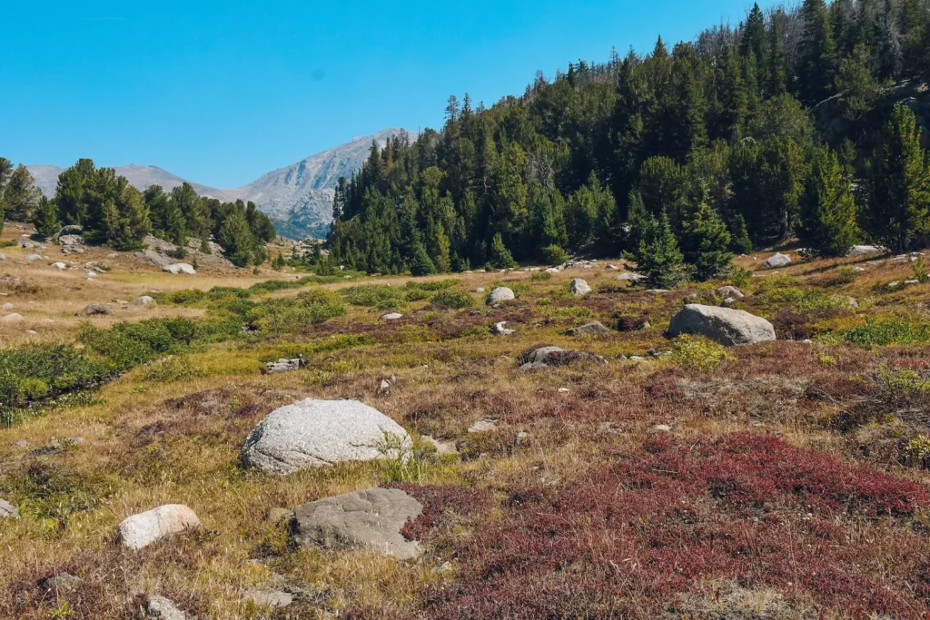
From the Fremont Trail, you will continue going through the valley. This part of the trail feels a little boring and monotonous, until you come over the hill side. You’ll walk through the trees before it completely opens up.
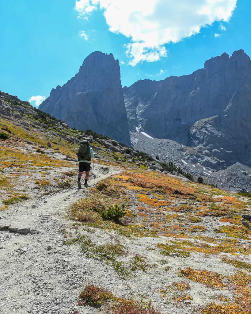
At this point, you will start to see the gorgeous mountains in front of you. I was in complete awe and had to stop to take it all in for a moment before continuing on. 😍
Dads Lake
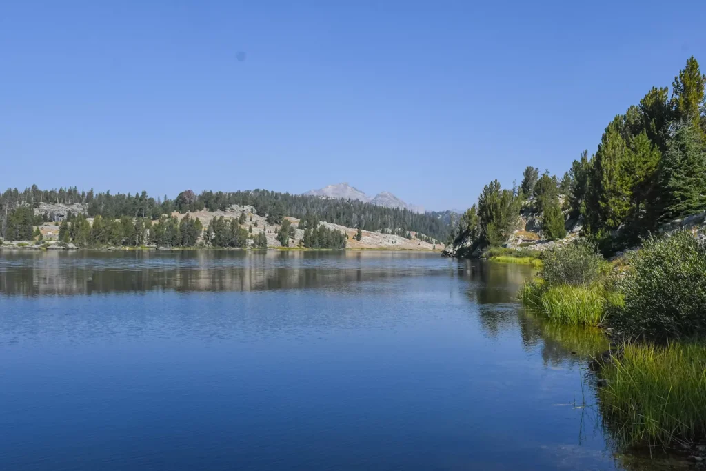
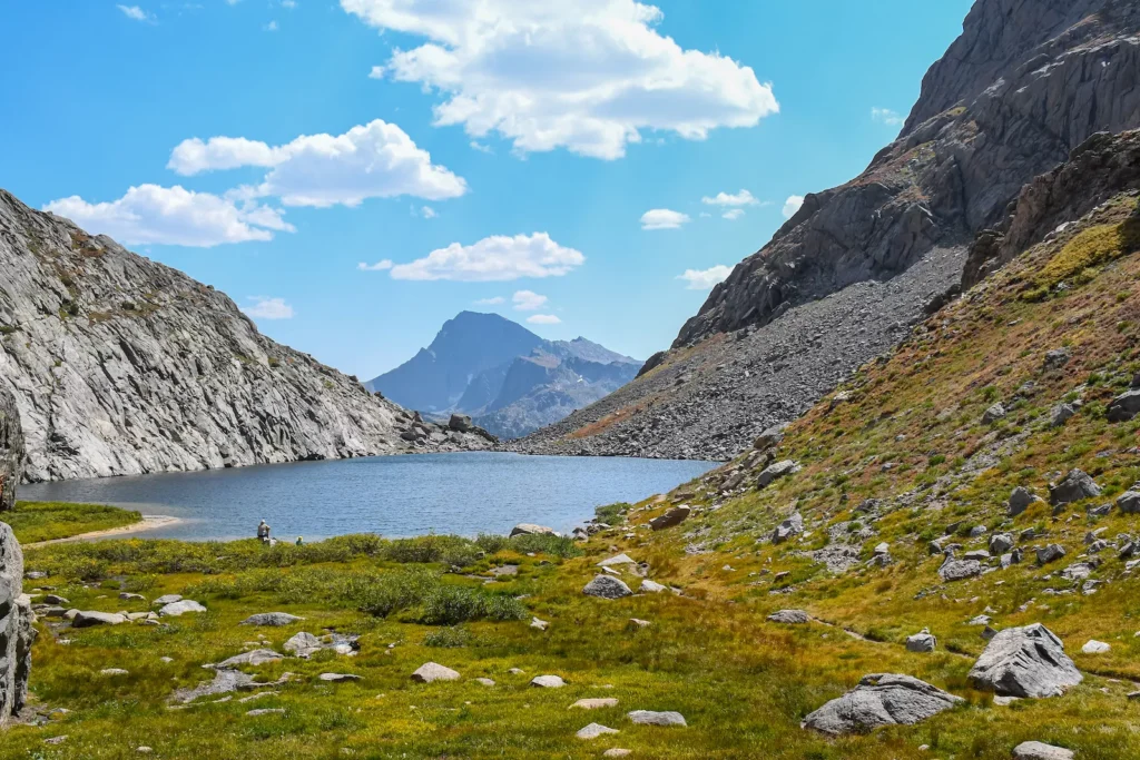
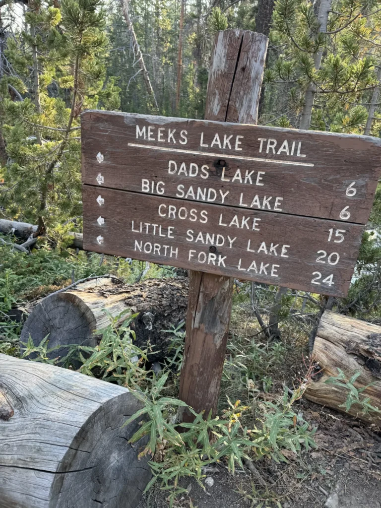
Finally, you will start to feel as if you are heading in the right direction as you make your way towards the jagged peaks. The first lake you’ll come to on your journey is Meeks Lake on your left.

From there, continue walking on the trail until you see Mirror Lake on your right. This was one of my favorite spots for a photo. It was stunningly gorgeous.
Finally, at five miles in you will see Dads Lake straight in front of you on the trail. On the right side are plenty of trees to sit on a rock under the shade and take a break. We chose to eat some protein bars here and rest for a little bit. If you have more than 3 days, Dads Lake is a great place to camp for the night.
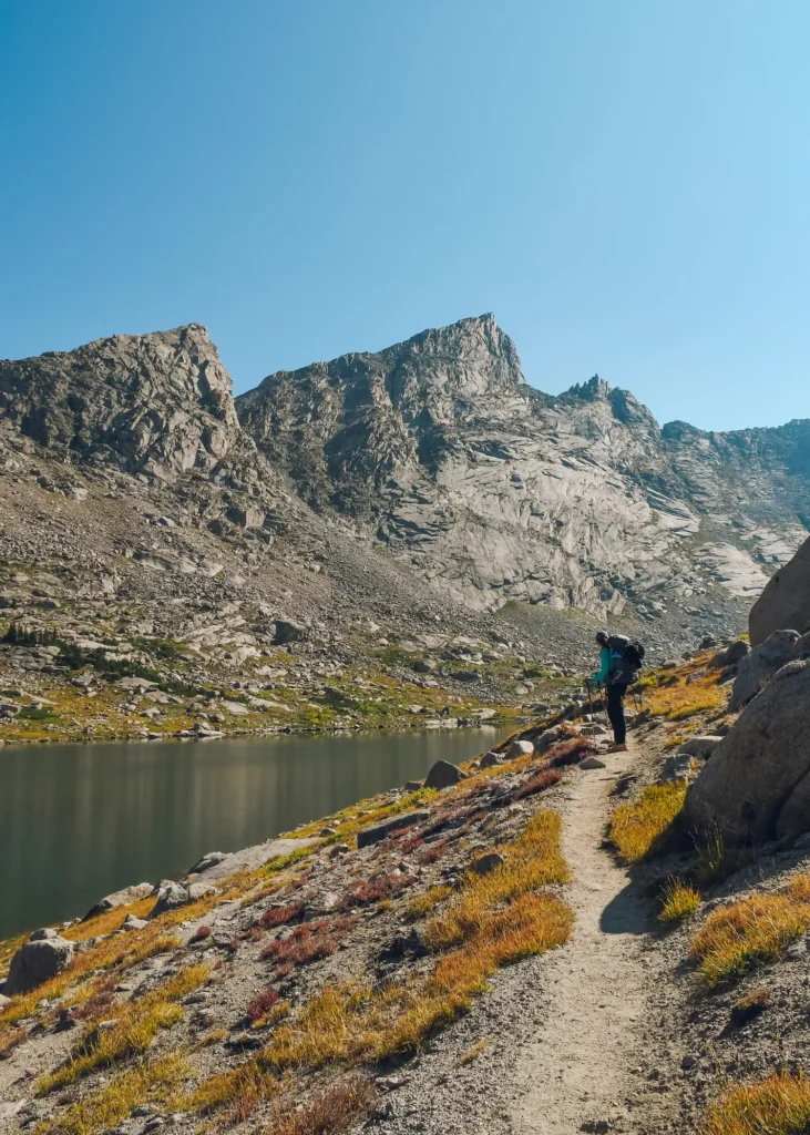
Shadow Lake
Continue further on the Fremont Trail until you pass Marms Lake. From there, you want to turn right and follow the Hailey Pass Trail for 1.6 miles, before turning onto the Shadow Lake Trail.
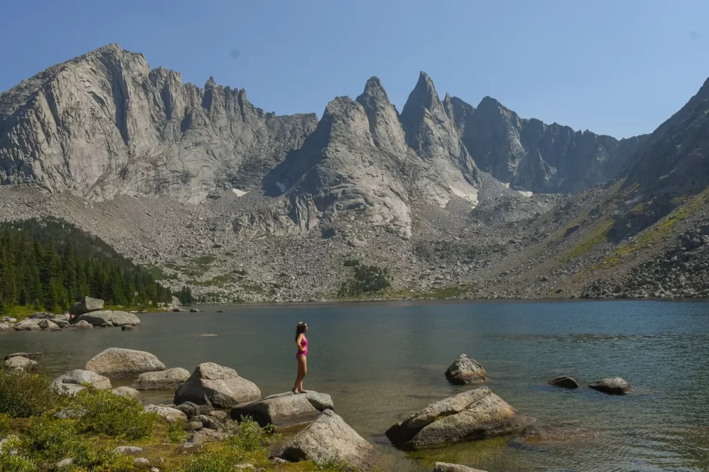
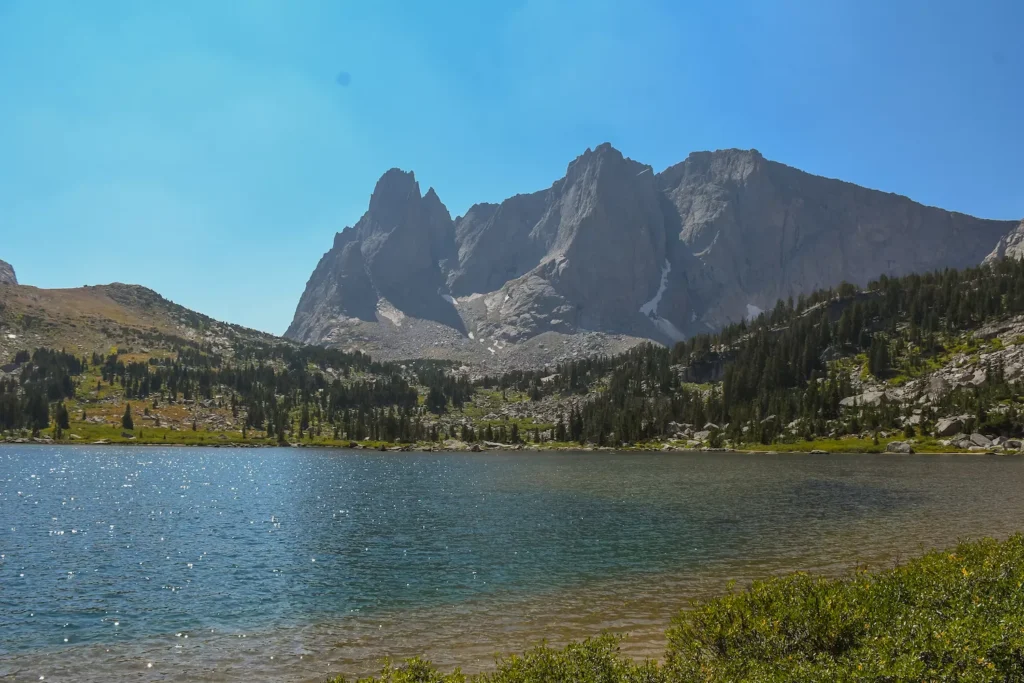
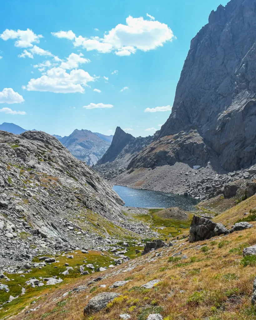
The last few miles of this can really feel tough after a long day of hiking, although you will pass lots of scenic areas on your way. But, if you just keep pushing you will make it to Shadow Lake and it’s so worth it! Shadow Lake is one of the most picturesque spots with two jagged peaks sitting right over the lake.

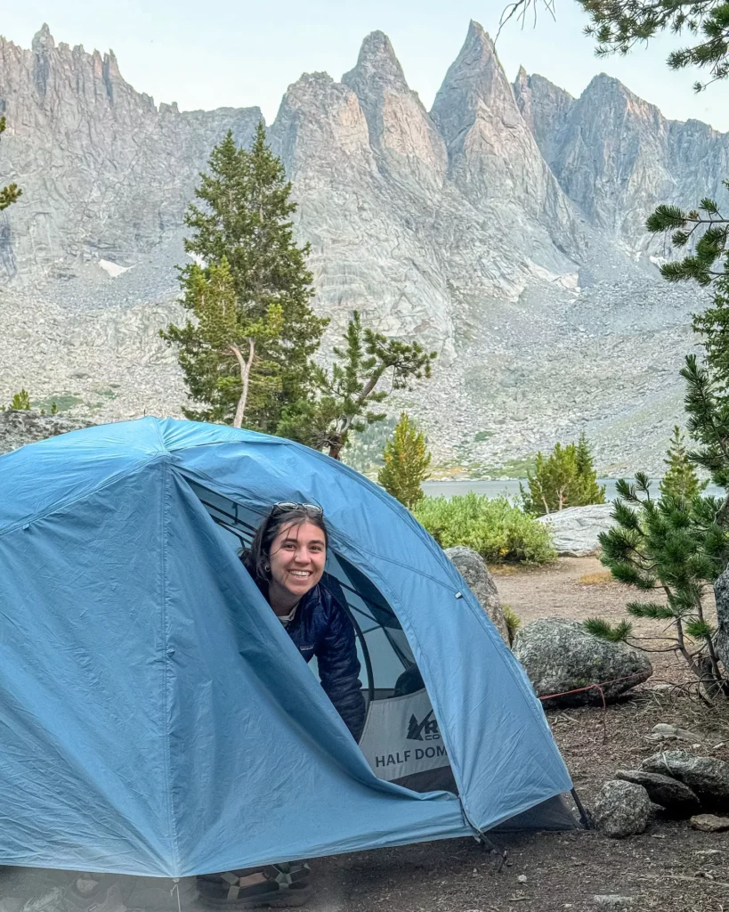
Lots of campers choose to set up their spot for the night by this lake, but there are plenty of places to choose from. Just make sure to camp 200 feet from the lake itself. Once you’ve set yourself up, you can spend the rest of the day swimming and enjoying relaxing in the serene setting.
Shadow Lake to Lonesome Lake
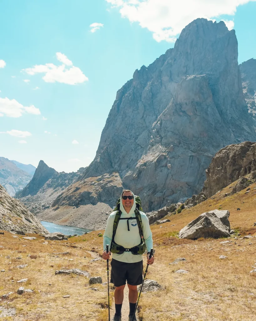
I hope you fueled yourself up the night before, because this day will test your limits as you finally make your way into the heart of the Cirque. If you choose to hike all the way to Big Sandy Lake, then there will be two tough pushes with steep elevation: Texas Pass and Jackass Pass.
But, if you allow yourself to take breaks and go slow, then you will make it! Plus, you’ll feel so proud of yourself when it’s done.
Distance: 3 miles
Elevation: 1100 Feet
The Lakes
One of the best parts of completing the Cirque of the Towers backpacking route is all of the spectacular lakes that you’ll pass. Immediately after leaving Shadow Lake, you’ll arrive at Billy Lake.
If you want a quieter spot to camp, then you may want to choose Billy Lake on night one.
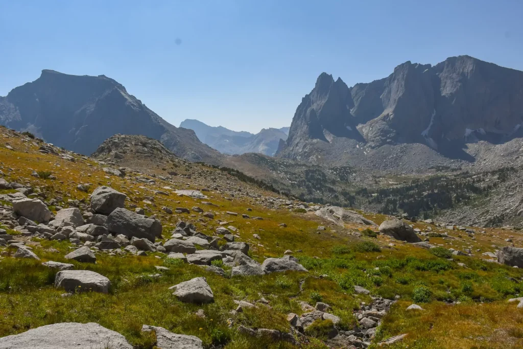
From there, you’ll pass two more lakes: Barren Lake and Texas Lake. You’ll see why Barren Lake gets its name as the area goes from grass and forests to a rocky bowl at the bottom of the mountain.
Gird your loins, it’s time for the tough part.
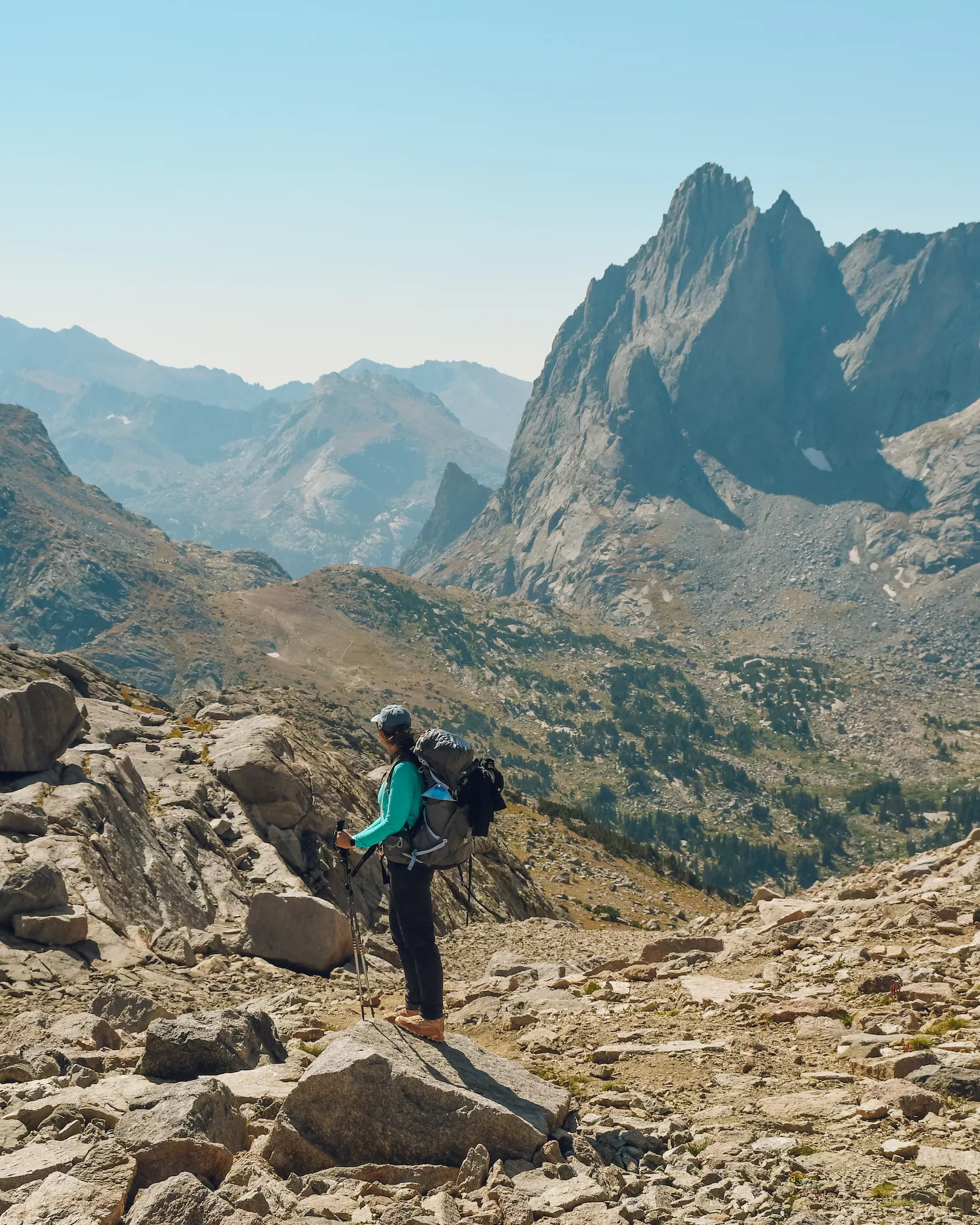
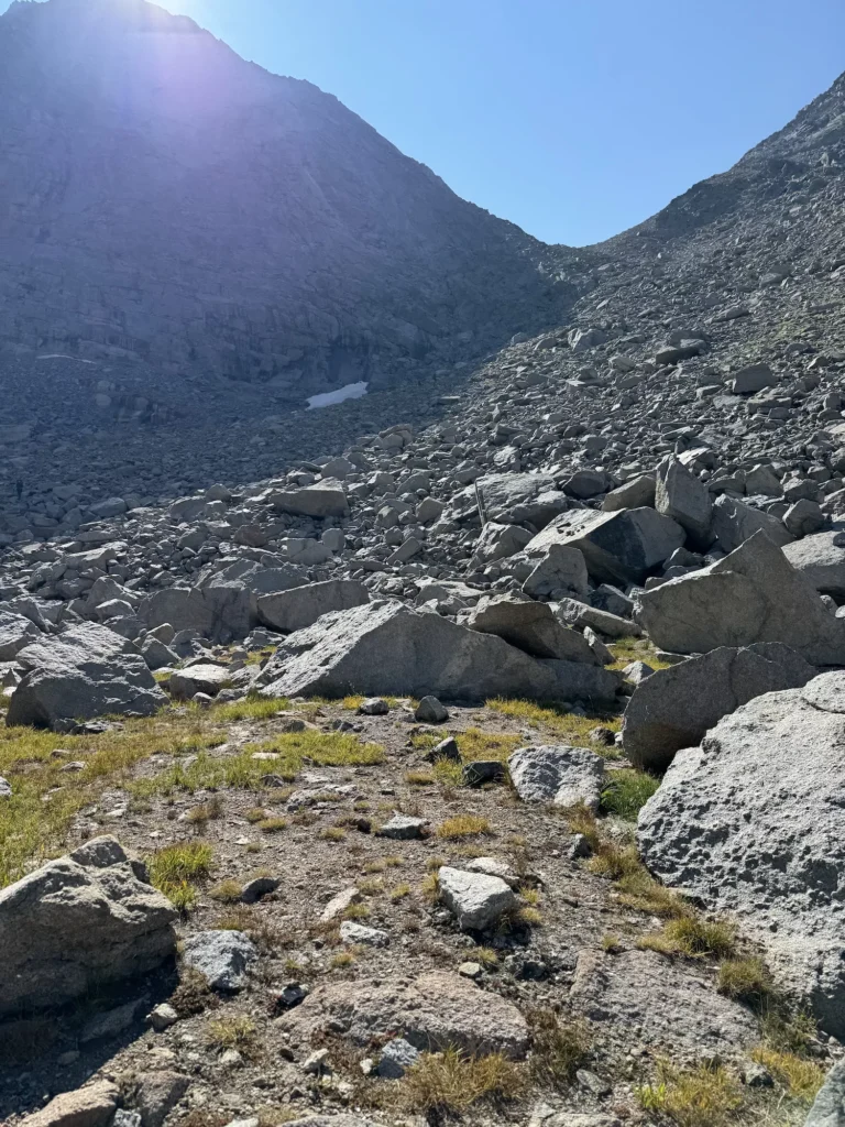
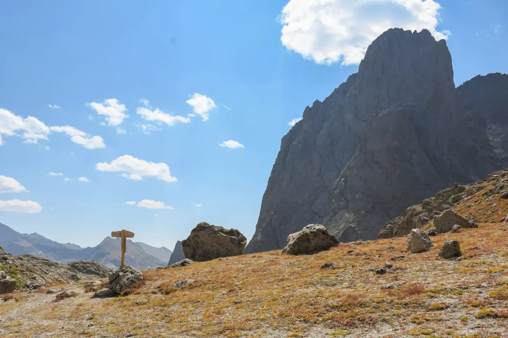
Texas Pass- Tallest Point in the Cirque of the Towers
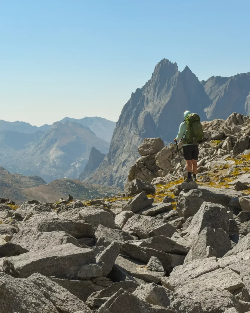
Here’s the toughest part of the whole journey… in just .3 miles you will have to hike up 700 feet to reach the top of Texas Pass.
As you get to the bottom of the pass, you can see people mentally preparing themselves for the ascent. It’s incredibly steep and rocky, so you will definitely want to take your time as you go up.

I’m pretty sure that I took a break every 5 steps. It’s no joke.
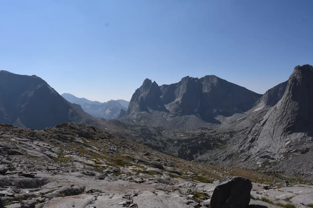
But, once you get to the top, you will see the breathtaking scenery all around you and you’ll finally be in “The Cirque”. I was seriously blown away by the landscape and it felt like we had transported ourselves to New Zealand or something. Stay here, have a bite to eat and take photos of the miraculous views!

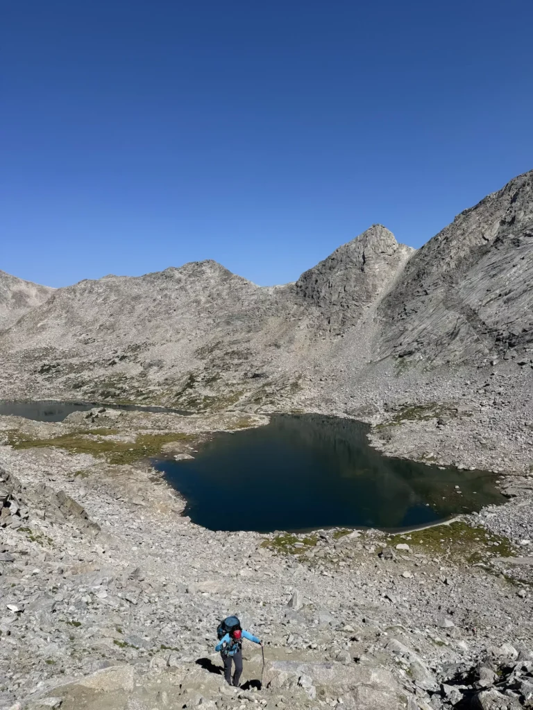
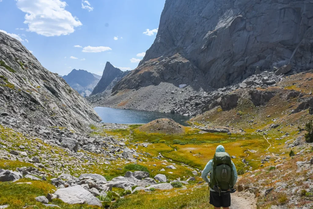
Lonesome Lake
Luckily, you’ll get a break after the challenging ascent, because it’s all downhill to Lonesome Lake. Although, I will say this part can feel a bit rough on your toes and knees, so go slow and use poles!
You’ll enter another forest before finally, coming out to Lonesome Lake. Although like I said earlier, I wouldn’t camp here because of the fecal matter in the lake, it’s a wonderful spot to stop for lunch.
If you do camp here, stay a quarter mile from the lake and DO NOT drink the water. 🚫
I honestly didn’t want to leave this gorgeous lake… but we had to move on.
Lonesome Lake to Big Sandy Lake
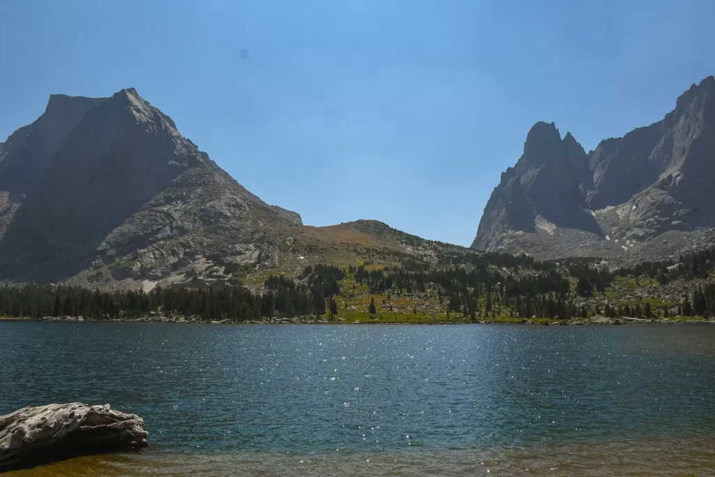
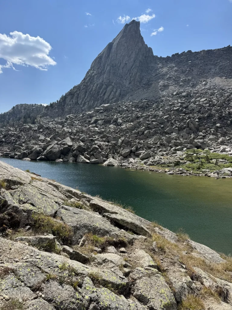
If you choose to go further on Day Two, then you’ll have to do another hard climb up Jackass Pass before passing a number of mesmerizing lakes. Finally, you’ll get to the last lake of your journey- Big Sandy Lake.
It’s a very large lake with plenty of spots for camping, which makes it very popular. Also, you’ll run into a lot of other backpackers who just went to Big Sandy Lake and back. It’s a very family friendly route!
Distance: 3.6 miles
Elevation: 700 Feet
Jackass Pass
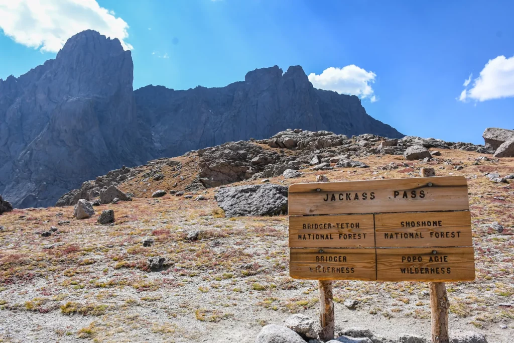
If you thought you were done with really steep climbs, think again. The trail to Jackass Pass raises up 500 feet in about .4 miles.
This time, there are a few switchbacks along the way, which may make it slightly easier, but it was still very hard. Hopefully, you had fueled yourself up enough at Lonesome Lake. But, it’s definitely going to have you huffing and puffing. Luckily, the view from Jackass Pass is insane! 🤯
Arrowhead Lake
From Jackass Pass, you can see over Arrowhead Lake. This lake is gorgeous, but it’s one of the most annoying parts of the trail, because it’s a huge rock pile.
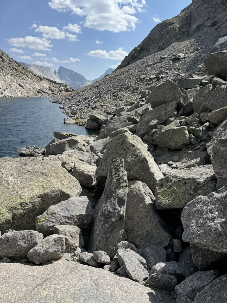
So, continue on the right side of the lake over the boulder field. Although it’s not as tough as climbing up the passes, you’ll just have to watch your footing a lot and go slow. My partner loves walking along boulders, but I was lagging far behind.
North Lake
Once you get to the end of Arrowhead Lake, you’ll mostly be walking downhill to North Lake. This is another fantastic lake to stop and swim if you want a break. But, we kept pushing to keep our momentum up.
You’ll walk along the left side of North Lake over some boulders. You will go up and down and up and down. Honestly, at this point you may be over it 😩, but you don’t have too much farther to go!
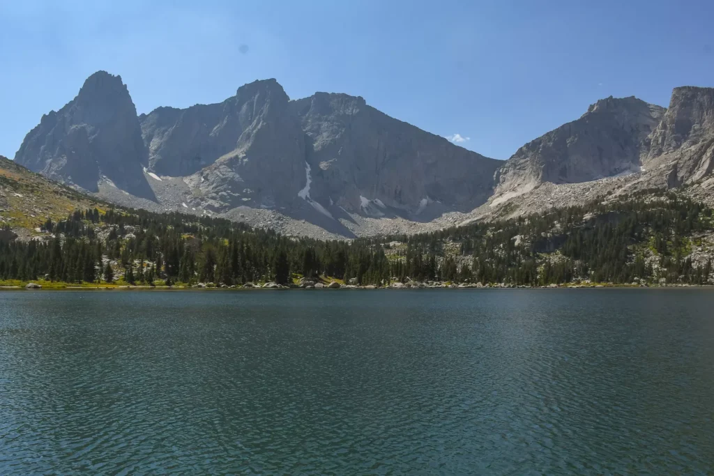
Big Sandy Lake
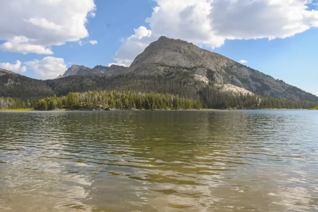
Finally, once you pass North Lake, you will only have a mile to go to Big Sandy! It’s pretty much all downhill for the entire rest of your journey. So, you can take a big sigh of relief. 😀
You’ll come out of the trees and you’ll see Big Sandy ahead of you. You can choose to either go left to find a camp spot around that way or go right. We ended up going towards the right/straight direction and found a wonderful spot with some shade.
This lake is half a mile long, so there are plenty of options to choose from! Now, you can just relax and take it all in.
Big Sandy Lake Back Home
Distance: 5.5 miles
Elevation: 50 Feet
Big Sandy Trail
Honestly, this trail is named Big Sandy for a reason. What I remember most is the soft sand under my feet and how good that felt after climbing on boulders and rocks.
Personally, I love an easy last day on a backpacking route and while you have miles to go, it’s relatively easy and flat!
Your last day you’ll start walking through the woods, before you get to the valley opening up again. Finally, you’ll meet back up with the turn-off spot for the Fremont trail and you’re home free in just half a mile after that!
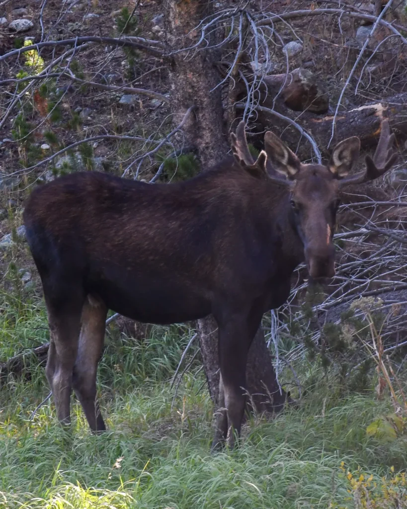
We even saw a moose on the way from the trailhead to our car!
Final Tips for Backpacking the Cirque of the Towers
Do not take backpacking the Cirque of the Towers on lightly. It’s a challenging route with tons of steep climbs and long mileage. Make sure that you are prepared before you go by planning out your route and testing all of your gear. But, if you plan ahead, train yourself, and pack plenty of water you’ll be ready for an incredible journey!
I hope you fall in love with this trek as much as I did. 💕
Let me know in the comments if you enjoyed this backpacking guide!
📍 Pin The Comprehensive Cirque of the Towers Backpacking Guide to Pinterest